Fun end to the week, poor next week

Western Australia Surf Forecast by Craig Brokensha (issued Wednesday September 7th)
Best Days: Tomorrow, Friday morning in the South West and Mandurah, Saturday in the South West, early Sunday in the South West and Mandurah
Features of the Forecast (tl;dr)
- Moderate sized, reinforcing SW groundswell tomorrow AM, easing into the PM and smaller Fri
- Light E/NE winds with weak sea breezes tomorrow, similar Fri but with fresher sea breezes
- Small-mod sized mid-period S/SW swell building Sat PM
- E winds ahead of weak sea breezes Sat, E/NE-NE tending fresher NW Sun
- Onshore winds and large, building surf through next week
Recap
The surf kicked up in size and power across all locations yesterday with favourable winds in protected spots through the morning across the South West, lighter and variable to the north with peaky 3ft sets into the afternoon.
Today conditions were clean and good across Perth and Mandurah with an easing mix of swells from 3ft, poor across the South West with weak, onshore 6ft waves. Conditions are now deteriorating across Perth as a trough brings S/SW winds.
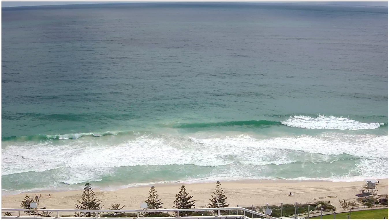
Lumpy, building surf yesterday PM
This week and weekend (Sep 8 - 11)
 The coming days are looking much better for the South West as today's trough clears to the east as a high quickly fills in from the west.
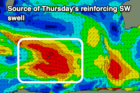
A reinforcing SW groundswell should keep 6ft sets hitting the exposed breaks around Margs, generated by W/NW gales pushing through the Southern Ocean earlier this week.
Mandurah should see 2ft waves with 1-2ft sets across Perth and light E/NE winds will create clean conditions ahead of weak sea breezes, providing fun waves all day.
This swell will ease into the afternoon, with smaller surf Friday morning under an E/NE offshore again. Fresher sea breezes are due into the afternoon so aim for the morning surf.
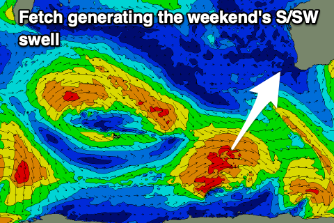 Into the weekend we've got a slow start to Saturday ahead of a new pulse of mid-period S/SW swell into the afternoon.
This will be generated by a relatively weak, small polar low forming east of the Heard Island region today, producing a fetch of strong to at times gale-force W/SW winds in our southern swell window.
It'll be fun in size across the South West and build to 4-5ft on the magnets, easing from a similar size Sunday and to 1-1.5ft in Mandurah.
 Conditions will be clean ahead of weak sea breezes, with Sunday seeing E/NE-NE tending fresh NW winds.
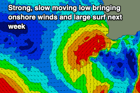
Longer term, as touched on in Wednesday's notes we've got a slow moving mid-latitude frontal progression due to move in through early next week, bringing, large, stormy and windy onshore surf from Tuesday.
All the swell will go to waste owing to the slow moving nature of the progression, with no improvement in the local winds and conditions until at the earliest next weekend. More on this Friday though.