NE windswell ahead, favouring the Mid North Coast for most size
Monday, 19 September 2022
NE windswell ahead, favouring the Mid North Coast for most size
Monday, 19 September 2022
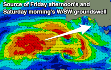
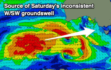
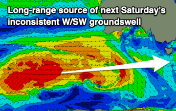
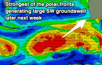
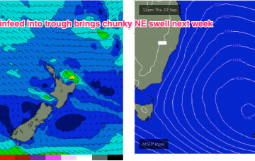
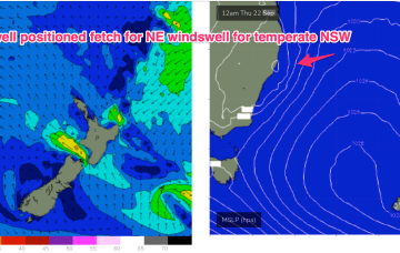
We have a typical looking Spring pattern with a weak high over the NSW interior and some flabby fronts passing South of Tasmania. An approaching trough series and inland low adds action mid-week as it tightens the pressure gradient with a more southerly located low, developing a N’ly fetch off the NSW Coast and another round of chunky NE windswell favouring the Mid North Coast for most size.