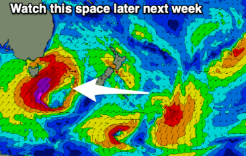
Building south energy later next week and weekend
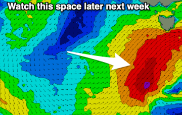
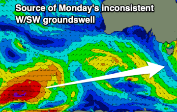
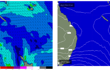
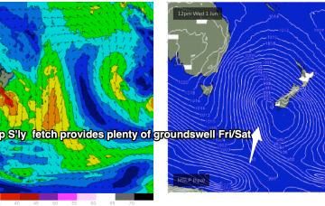
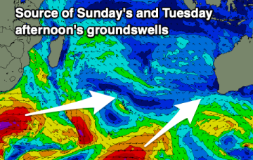
Fading energy into the weekend ahead of building levels of S'ly swell in size and period later next week and weekend.
Nothing major until mid-late next week but with cold weather and onshore winds.
Building surf with improving and strengthening offshore winds, tricky mid-late next week.
A windy and stormy weekend of surf with protected spots down South fairing best, mostly poor and onshore next week.
Following our first cold outbreak of the season last weekend and earlier this week, we've got another progression of cold fronts and polar air due to make its way up and across us through next week under the influence of a strong node of the Long Wave Trough. This node will be slow moving, taking its time to cross the Tasman Sea and then across New Zealand next weekend.
Brisk south-westerly winds and a complex low pressure gyre in the Tasman Sea, with multiple cold fronts and a deep S’ly fetch of gales extending down to 55S have ushered in the first day of Winter.
Conditions improve along with fun pulses of swell from the south-eastern quadrant.
No change to the outlook, winter cold fronts are now pushing across the south-east of the country with S swells for areas south of Fraser Island.
Brisk westerly winds and a complex low pressure gyre in the Tasman Sea, with multiple cold fronts and a deep S’ly fetch of gales extending down to 55S have ushered in the first day of Winter.
A good run of groundswells and favourable winds develops from the weekend.