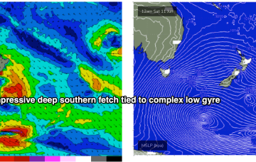
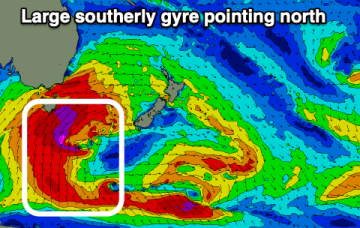
Large Southern Ocean gyre points north
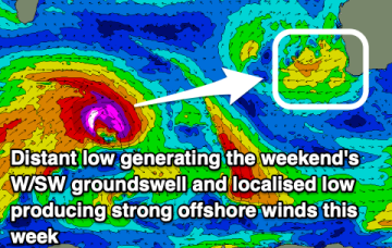
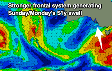
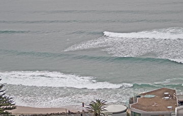
We've got successive increases in southerly swell due over the coming week, biggest on the weekend and early next week.
High pressure support along an elongated front and another deep low pressure gyre forming well South-east of the South Island super-charge a deep southern fetch Fri into Sat with an area of 20ft seas sling-shotting agressively North-east into the Tasman Sea.
Windy conditions with new swells on the way, spot selection will be key.
Both those factors will drive a series of strong cold fronts this week, with no meaningful swell for the CQ coast due to the acute Southerly swell direction.
A strong node of the long wave trough is steering fronts into the Tasman Sea while a negative phase of the SAM (Southern Annular Mode) is bringing the southern Ocean storm track into a more northerly latitude, closer to the Australian continent and Tasman Sea. Both those factors will drive a series of strong cold fronts this week, with a step-ladder effect likely as each subsequent front works on an already charged sea state.
Persistent onshore winds with only short periods of lighter, cross-offshore breezes and moderate pulses of southerly swell.
A strong node of the Long Wave Trough is steering fronts into the Tasman Sea while a negative phase of the SAM (Southern Annular Mode) is bringing the southern Ocean storm track into a more northerly latitude, closer to the Australian continent and Tasman Sea. Both those factors will drive a series of strong cold fronts this week, with a step-ladder effect likely on swell pulses as each subsequent front works on an already charged sea state.
A slow moving node of the Long Wave Trough will direct persistent, strengthening polar fronts through our swell window bringing lots of swell but less than ideal winds.
Using today's results in Southern NSW as a proxy, we should see some solid south swell across Northern NSW on Saturday.
Sunday’s NW quadrant wind trend will be related to an advancing frontal progression across the south-eastern corner of the country, associated with an amplifying Long Wave Trough.