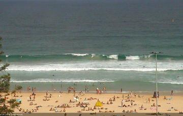
Continuation of tricky winds and small swells
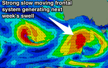
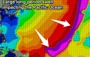
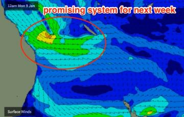
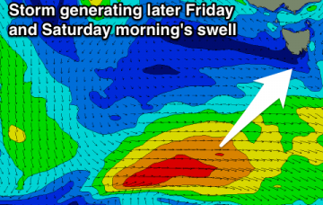
Our SE swell from today will ease into Thursday but we’ll see a continuation of peaky E’ly swell from a modest ridge through the central/Northern Tasman Sea.
Fading SE swell tomorrow, with a slight kick in S'ly swell later Friday, fading Saturday. N/NE windswell for Sunday with improving winds.
Tiny tomorrow with a building SW groundswell Friday along with a freshening E/NE wind. Easing swell Saturday and then tiny until later next week.
Small and average tomorrow with a freshening onshore wind, stronger larger and stormier Friday ahead, easing Saturday and Sunday with improving conditions. Fun swells for next week.
Junky swell tomorrow, cleaner and easing Friday. Small new swell for Saturday morning with offshores most of the day. Good new W'ly swell for the Mid Coast Sunday afternoon with improving winds. Solid swell Thursday next week as well.
Small easing swell tomorrow and Friday with variable winds developing each morning. New swell for Saturday morning with a northerly breeze. A stronger W/SW groundswell is on the cards for next Thursday.
Mix of N/NE and NW swells across the North Shore until next weekend, with a large groundswell on the cards for P-Pass and PNG (including Hawaii).
Good SE groundswell with a morning offshore tomorrow, easing through the rest of the week. Small N/NE windswell for the weekend.
Model data has the S’ly change into the Gold Coast just after midnight tonight, reaching the Sunshine Coast around dawn.
Easing SE swell tomorrow with a morning offshore, tiny Wednesday with an inconsistent W/SW groundswell. New swell for later Friday with an onshore wind, clean and easing Saturday