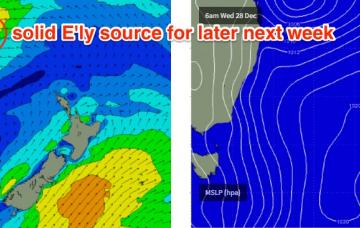
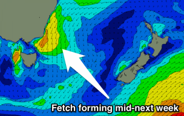
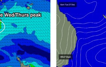
Stacks of easterly swell on the way
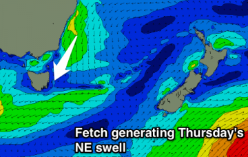
We’re looking at a slow increase in size over the coming days towards a plateau in and around very late Wednesday through Thursday.
Small levels of north-east swell this week, onshore tomorrow and cleaner each morning from Wednesday. Biggest Thursday morning.
A stationary blocking high in the Tasman Sea will direct N/NE winds across Southern NSW right through this week and into the weekend
Tiny waves for the period, check the North-East Coast forecast for options.
Building SW groundswell tomorrow with onshore winds, easing Wednesday as less than ideal conditions persist. Smaller but cleaner Thursday.
Good easing W/SW groundswell over the coming days ahead of a new strong acute W'ly swell Thursday and Friday.
Easing W/SW swell with good winds for the beaches for most of the week, but only worth surfing Tuesday and Wednesday.
Jeez, next week looks very exciting.
In Wednesday’s notes I mentioned a possible tropical depression near New Caledonia early next week that had the potential to generate a stronger E/NE groundswell for the second half of next week. Fortunately, the models have come inline with this thinking and they’re expecting a substantial easterly dip to form between SE Qld and New Caledonia around Tuesday.
Small most of the weekend, bigger out of the NE next week, with a temporary S'ly change Monday afternoon.