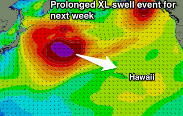
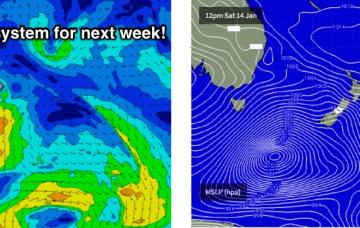
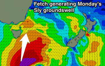
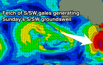
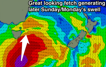
Good S'ly swell later Sunday/Monday
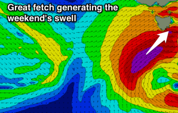
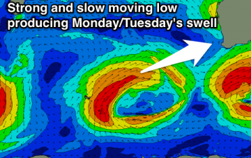
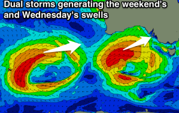
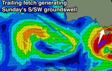
Tiny tomorrow with a building S'ly swell later Sunday, easing slowly Monday with favourable winds. Small fun S/SE swell for Wednesday through Friday.
Tiny tomorrow morning, with a rapid increase in raw W/SW swell tomorrow afternoon and evening, peaking out of the SW Sunday morning and then easing out of the S/SW Monday.
Good easing SW swell tomorrow with offshore winds, average Sunday. Good new W/SW swell building Monday but with an onshore wind, cleaner and slowly easing Tuesday and Wednesday.
Large onshore swell building tomorrow, easing Sunday, with a reinforcing S/SW pulse down South, along with E/SE winds. Best down South Monday morning.
Large building W/SW groundswell Saturday with a good W/NW wind for the Surf Coast Saturday morning and early afternoon. Easing W/SW and new S/SW swell Sunday with early W/NW breezes around Torquay. Light winds and easing surf Monday.
Moderate to large NW swell for Hawaii tomorrow, followed by an XL swell Friday afternoon, easing Saturday. Another longer lived XL swell from the W/NW Wednesday through the end of next week.
The anchored E’ly fetch south of New Caledonia and Fiji over the last few days is generating a minor bump in size that should arrive overnight, and show best early Thursday morning.
The models have slightly strengthened the NE fetch off the Hunter/Mid North Coast on Friday afternoon and evening, and with some luck the associated swell increase will persist into Saturday morning.
A small increase in N/NE swell through the day Friday with improving winds from mid-afternoon.
Easing W/SW swell tomorrow and further Friday, with a late increase in new W/SW swell later Saturday ahead of a stronger S/SW swell Sunday and Monday.