Small swells continue across the South Arm

Southern Tasmania Surf Forecast by Craig Brokensha (issued Monday 18th November)
Best Days: Early tomorrow, Wednesday morning, Thursday morning, later Saturday, Sunday morning
Recap
A bit of swell for the weekend, but west in nature and not the cleanest conditions. Yesterday morning saw the most size, back to 1-1.5ft this morning.
This week and weekend (Nov 19 - 24)
A strong front that's passing under us today should produce a small pulse of W/SW swell for later today, easing back tomorrow from 1-2ft across Clifton.
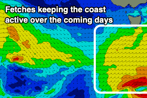 A low will actually form at the base of this front, with a fetch of stalling W/SW gales generated just within our swell window.
This should keep 1-2ft waves going into the afternoon and Wednesday morning, with Thursday even still likely to see 1-1.5ft sets out of the S/SW.
Winds tomorrow look W/NW early, shifting W/SW through the morning and strong S/SW into the afternoon, with N/NE tending E/SE winds on Wednesday. Thursday morning will be clean again with a gusty N/NE'ly ahead of a S/SW change.
The next increase in surfable swell is due over the weekend as a slow moving frontal progression pushes in from the west.
A good elongated and slow moving fetch of strong W/SW winds will be generated just within our swell window, being a touch too north to be ideal.
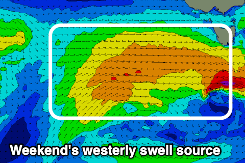 A small mid-period W/SW swell is expected off this progression, building Saturday likely to 1-2ft later in the day and peaking Sunday in line with model guidance and to 2ft or so.
Winds look favourable and W/NW all Saturday, NW tending W/NW Sunday ahead of sea breezes.
Longer term a secondary weaker front may move in early next week, followed by a stronger low later next week, but more on this in Wednesday's update.