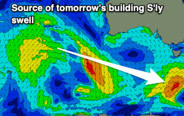
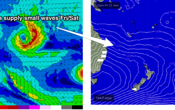
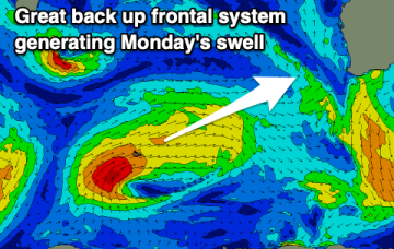
Fun swell for Monday though windy
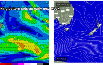
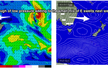
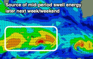
Today's swell will ease into the weekend with less favourable winds, with some new swell for early next week as winds strengthen from the south-eastern quadrant.
This is maintaining the ridge of high pressure along most of the East Coast, with a slight and slow easing of pressure gradients expected over the weekend.
There's no improvement to the current outlook with tiny swells and generally favourable winds.
Winds are favourable for the beaches but the Southern Ocean is having a quiet spell. There aren't many surfing options for the coming period.
Current ASCAT (satellite windspeed) passes show a large area of storm force W’ly winds well aimed towards Hawaii as the storm tracks towards the Dateline.
Unfortunately the blocking pattern is in a poor position for East Coast Tasmania with both swell windows effectively shut down as high pressure slowly moves to sidle up next to Tasmania.
A mix of swells for the coming period with cleaner conditions on offer.
The ridge really starts to build along the CQ coast later Thurs, reaching peak strength of 20-30 knot winds through Friday.
Nothing major swell wise but there are fun days on the cards for all regions this period.
A classic Summer blocking pattern is now setting up with a slow moving high drifting well south of Victoria and a series of troughs interacting with a strong high pressure ridge which has reached Central NSW and is now building into more sub-tropical regions.