Average weekend, windier but better next week
Friday, 15 March 2024
Average weekend, windier but better next week
Friday, 15 March 2024
Give the weekend a miss and try and work around next week's windy swells.
Give the weekend a miss and try and work around next week's windy swells.
Make the most of the coming days of cleaner conditions down South before S-SE winds kicking in from Tuesday. The Mid Coast should offer a few fun runners.
Make the most of the clean run of small waves on the beaches over the coming days. The outlook from Tuesday afternoon is poor.
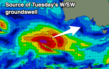
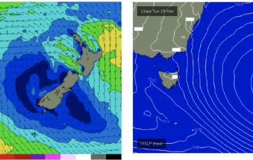
Strong swell this afternoon, easing into tomorrow and the weekend with easing levels of localised W/SW swell.
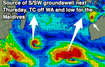
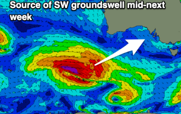
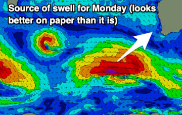
The fetch generating the swell looks stronger, bringing an upgrade in size.
The swell will fade into the end of the week, increasing slowly on the weekend but with deteriorating conditions.
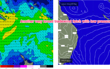
We’ve still got a broad trade wind flow in the Coral Sea, extending out into the South Pacific and anchored head and tail by low pressure along the monsoon trough. That’s producing plenty of surf in the sub-tropics although we’ll now see a slow easing trend into the end of the week.
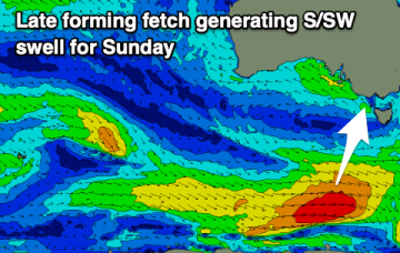
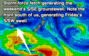
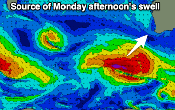
Into the weekend and we’re still on track for some strong S/SE groundswell from a stalled low near the ice shelf today with ASCAT passes showing strong gales to storm force winds in the fetch.
Winds are the main issue over the coming days, improving on the weekend only when the swell fades.
We’ve still got a broad trade wind flow in the Coral Sea, extending out into the South Pacific and anchored head and tail by low pressure along the monsoon trough. That’s producing heavy swells in the sub-tropics (full blown Point surf equivalent to cyclone swells) although we’ll now see a slow easing trend into the end of the week.