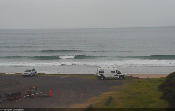
Poor quality and easing swells as winds slowly improve
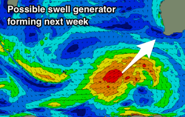
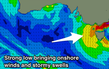
Abating winds and easing swells over the weekend, but no decent size or energy once winds finally swing offshore.
The North Shore goes flat ahead of a winter-calibre storm and XL NW groundswell event early next week.
The N’ly windswell doesn’t interest me quite as much as the incoming SE swell. More in the Forecaster Notes.
Lots of swell over the coming period but tricky winds and pulses revolving around a complex Tasman Low.
Satellite data over the last few days has showed our fetch off New Zealand’s South Island to be quite strong. Even better, we’re looking at locally freshening NW tending W/NW winds. It’ll be well worth coordinating some water time. More in the Forecaster Notes.
Strong onshore winds and stormy increase in S/SE swell through the end of this week, easing off into the weekend.
No significant swells on the cards until late in the forecast period but there'll be fun waves at swell magnets for keen surfers to end of the week.
A strengthening and beautiful looking mid-latitude is currently inbound with stormy swells on the way. A window of OK waves for the weekend as it clears.
A slight improvement in the wind outlook for exposed beaches before the wind and weather deteriorate.
A small fun swell tomorrow before becoming tiny until some larger and stronger swells start to fill in from Sunday through next week.