Poor weekend, better options next week
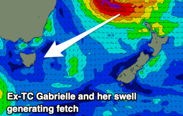
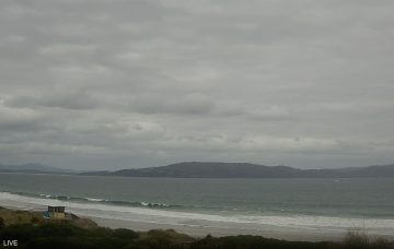
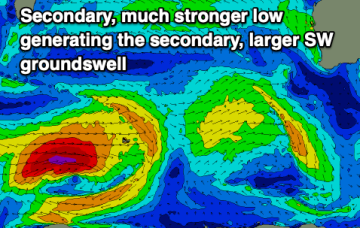
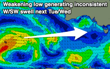
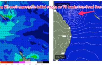
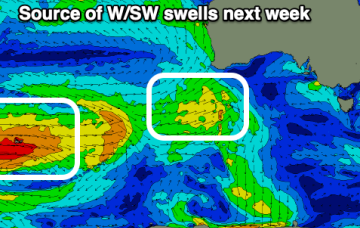
Weak windswells and average winds for the weekend, better into next week with a tiny, teasing swell on the Mid, better down South from Wednesday.
Distant W/SW swells with favourable winds developing from mid-next week following a trough and change tomorrow afternoon/Sunday.
We should start to see some long period N/NE swell appear, generated by the early stages of TC Gabrielle (developing tonight, actually).
There's not much to work with over the coming days, but next week we'll see strong energy from ex-TC Gabrielle.
Over the next couple of days, TC Gabrielle will strengthen considerably and track south-east through the Coral Sea, enroute to the Northern Tasman.
The current swell will ease, best tomorrow.
The end of the week is generally poor thanks to the lack of swell. More energy is due from Sunday, though with poor winds into next week.
There's a mix of flukey swells this period with plenty of windows of lighter winds as well. The weekend and early next week look generally poor for the South Coast.
There's not much to work with this period though a few windows will open up for the beaches. Right now on the Surf Coast is well worth a paddle.
A convective cloud mass between the Solomon Islands and Vanuatu is expected to consolidate and deepen into a tropical cyclone by mid week, tracking back into the Coral Sea towards the tropical QLD coast before recurving and drifting Southwards through the Coral Sea and eventually towards the North Island. Solid swell from this system is expected across most of the Eastern Seaboard.