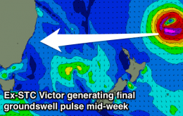
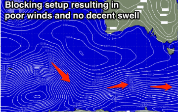
Generally average period with limited windows of clean conditions
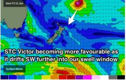
Friday, 22 January 2016

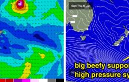
Generally average period with limited windows of clean conditions
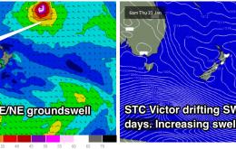
Friday, 22 January 2016
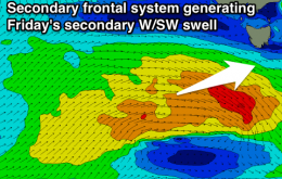
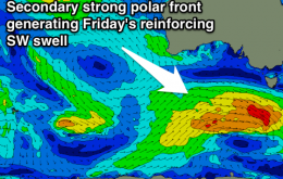
Gradually easing swell with onshore winds for the most part of the weekend continuing into early next week.