Slow improvement in surf

South Australian Forecast by Craig Brokensha (issued Friday 25th September)
Best Days: Sunday morning keen surfers down South, selected spots Monday South Coast, swell magnets South Coast Tuesday
Recap
A drop in swell and swing in direction to the S/SW yesterday leaving tiny, onshore waves across the Mid Coast, good fun down South with clean 2-3ft sets. Winds strengthened into the afternoon kicking up some windswell on the Mid, while today a change has moved through bringing choppy/stormy 2ft+ waves. The South Coast was clean in protected spots at dawn but has now been ripped to shreds with the change proper.
This weekend and next week (Sep 26 – Oct 2)
A cold and broad low has moved in and across us, bringing the cold weather and strong onshore winds and we'll see these poor conditions continuing into tomorrow as the low continues to push east.
Strong S/SW winds will continue tomorrow, easing a touch into the afternoon while swinging more SW and this will be with a moderate sized and windswelly S/SW swell, generated by strong S/SW winds pushing up and into us.
 The South Coast will be a choppy 3-4ft, easing into the afternoon with choppy 1-1.5ft waves on the Mid Coast.
Our more variable winds for Sunday morning are still on track as the low pushes further east, though with onshore winds right up until dawn, the South Coast will likely still have lots of lump and wobble. The surf looks to be smaller and back to 2ft+ or so across Middleton, tiny on the Mid Coast.
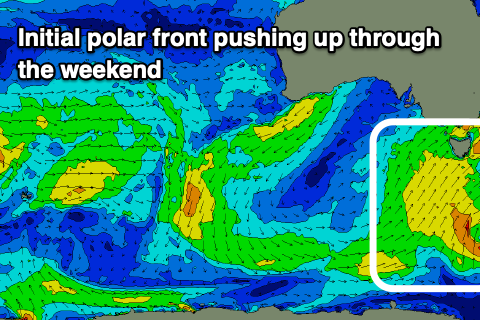
Into the late afternoon and more so Monday a fun pulse of new S'ly swell is due, generated by a polar front pushing up and towards Victoria on Saturday. The swell should kick to 3ft later in the day across Middleton but with SE sea breezes, holding 3ft most of Monday before easing from 1-2ft on Tuesday morning.
With the southerly direction of the swell, with Mid will be tiny to flat.
Winds will improve for selected spots on Monday, swinging NE and fresh, tending E/NE into the afternoon.
 Tuesday will be cleaner, but as pointed out above, small with fresh N/NE tending N/NW winds.
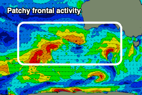
We then look to the mid-latitude frontal activity that's forecast to move in from the west through next week. Before this there's no swell due, with the first possible signs of energy popping up Thursday but more so Friday.
Initial activity in our far swell window will be superseded by close-range activity in and under the country next Wednesday/Thursday onwards. It all looks a little patchy at the moment and with no real strength or size, but we'll have a closer look at this Monday. Have a great weekend!