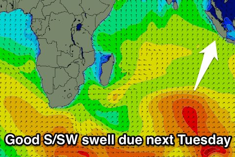
Two strong swell pulses with favourable winds

Nias, Mentawai, South Sumatra forecast by Craig Brokensha (issued Thu 25th Sep)
Best Days: Every day over the coming period
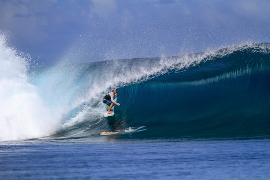
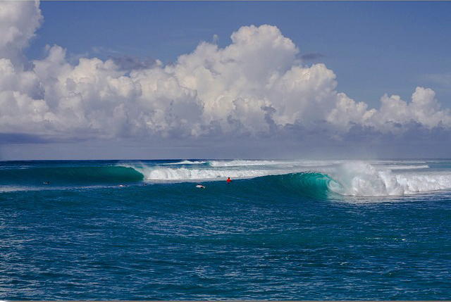
Attached photos are from Kandui Villas' stella run of swell through August. Click through for a more detailed report of the month and some great images.
Friday through Monday (Sep 26 - 29)
A fun pulse of S/SW groundswell through yesterday has backed off a touch into today and will continue to ease overnight, bottoming out tomorrow morning.
During the day though a strong long-range S/SW groundswell is due to arrive, building into the afternoon and peaking Saturday morning around the Ments (overnight around South Sumatra). This source of this swell discussed in previous forecasts was a vigorous but distant polar low, with inconsistent but strong 6ft+ sets due to develop through the afternoon in the Ments (8ft+ in South Sumatra) before peaking at 6ft to occasionally 8ft at exposed breaks in the Ments Saturday morning.
Light SE winds are due at the swells peak, while South Sumatra will see fresher SE-S/SE winds. A steady drop in size is due through the day Saturday and further through Sunday as SE winds strengthen across all regions.
Come Monday morning a low point is due but exposed spots in the Ments should still be 3-5ft, with 4-5ft+ waves in South Sumatra as winds ease a little.
Next Tuesday onwards (Sep 30 onwards)
Tuesday's consistent and largish S/SW swell is still on track with a strong node (peak) of the Long Wave Trough currently passing through the Southern Indian Ocean, steering a vigorous polar front fairly north in latitude towards Eastern Indonesia.
Wind speeds won't be especially great but the projection is great and should produce a consistent S/SW groundswell for Tuesday (arriving later Monday) to 6ft to possibly 8ft across exposed spots in the Ments and a more noticeable 8ft across South Sumatra.
A slow drop in size is due into Wednesday, Thursday and Friday morning with the next increase in size possibly being seen during Friday afternoon. We'll look at this in more detail on Tuesday though.
16 day Mentawai forecast graph
16 day Nias forecast graph
16 day South Sumatra forecast graph
Comments
I've run out of time to update the Ments forecast today, but we're looking at a slow easing trend in size from tomorrow through the rest of the week, bottoming out Friday ahead of a new long-range S/SW groundswell Saturday followed by a more consistent swell Sunday evening/Monday.
Each swell looks to be in the 6ft range at exposed spots in the Mentawais ahead of a slower period from Tuesday onwards.
Will update in more detail on Thursday.