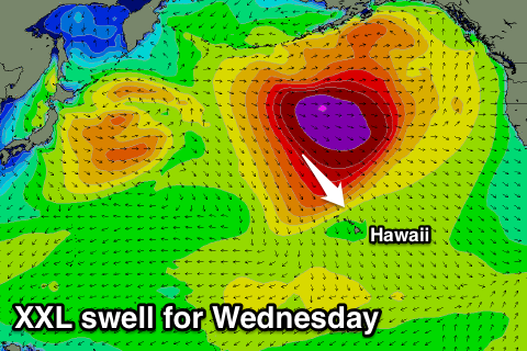
XXL swell for Wednesday, Eddie is go

Hawaii North Shore forecast by Craig Brokensha (issued Tuesday 9th February)
Best Days: Tomorrow, experienced surfers only from Wednesday through Friday and then Sunday through Tuesday
This week and next (Feb 9 - 19)
A mix of N/NW swells filled in yesterday with poor N/NW winds, holding into this morning as average onshore winds continued.
Cleaner conditions are due into tomorrow morning as the surf eases back from the 6ft to occasionally 8ft range across swell magnets on the North Shore, but this is just the lemon next to the pie, that pie being an XXL swell due Wednesday.
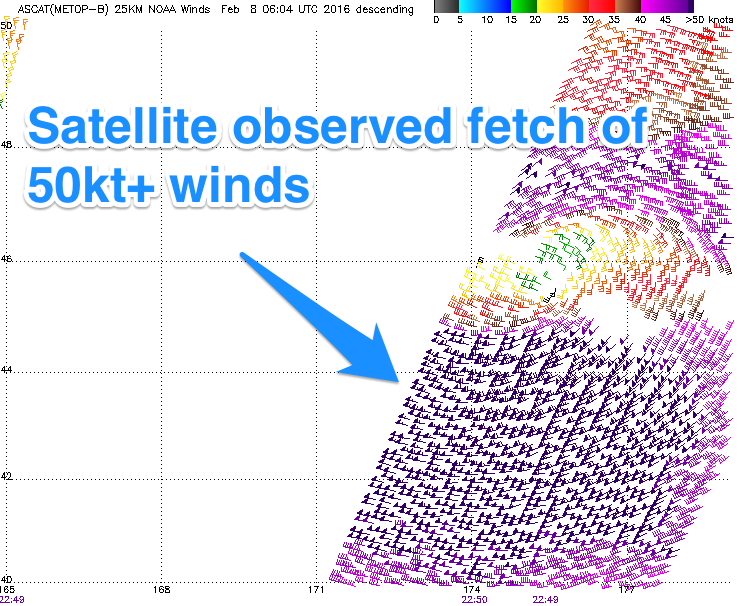
Currently a deep, powerful and expansive low pressure system is sitting south between the Kamchatka Peninsula and the Aleutian Islands.
Satellite observations have already registered a vast fetch of storm-force W/NW winds, with a broader area of supporting severe-gales to the south.
This low will project south-east towards Hawaii today while weakening just a touch, stalling to the north-northwest and continuing to aim an elongated fetch of severe-gale NW winds through Hawaii's northern swell window.
This has lead to the Green Light for the Eddie Aikau event to be issued, with the event being webcast early Thursday morning Australian time.
A long-period XXL swell will be generated, with the fore-runners arriving Tuesday night in the 22s range, with the bulk of the groundswell arriving out of the NW Wednesday mid-morning, tending more N/NW through the day.
The swell should peak through the afternoon/evening in the 20-25ft range with larger sets at deep water offshore reefs. This is similar to the swell seen last Wednesday although arriving earlier and with a touch less consistency. With this there's more than likely to be a few close-out sets at Waimea again with the longer-period energy.
 A secondary N/NW groundswell pulse from the low stalling to our north should keep large waves hitting exposed breaks into Thursday morning, with easing surf in the 20ft+ range, further down from 10-12ft Friday morning, bottoming out Saturday morning.
Conditions Wednesday will be good through the morning with variable winds ahead of NE sea breezes, with fresh E/NE trades kicking in Thursday and persisting Friday.
Our next significant swell is due Sunday and Monday, but strengthening NE winds Monday will create poor conditions.
This W/NW veering NW groundswell event will be generated by a broad and slow moving frontal progression developing off Japan through over the coming days, aiming a fetch of gale to severe-gale W/NW winds towards us, followed by a better NW fetch.
The initial W/NW groundswell for Sunday will be the least consistent, arriving through Saturday night and building steadily through Sunday from the 8ft range, up to 10-12ft+ through the afternoon.
The secondary NW pulse should be more consistent and around the same size-range but of lower period, peaking Tuesday before tailing off through Tuesday and Wednesday.
As touched on above, Sunday will be best with weak E/NE trades, strengthening from the NE Monday before veering back to the E/NE through Tuesday and easing. We'll have another look at this Thursday though.