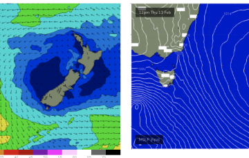
We've got a mix of easing E/NE energy and building S/SE swell with decent winds.
Primary tabs
/reports/forecaster-notes/eastern-tasmania/2025/02/14/great-few-days-surf-ahead
Craig
Friday, 14 February 2025

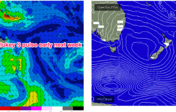
/reports/forecaster-notes/eastern-tasmania/2025/02/12/sizey-the-ne-then-s-over-the-weekend
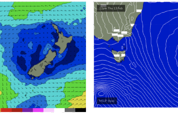
freeride76
Wednesday, 12 February 2025
An active monsoon pattern is seeing a tropical low drifting in the Coral Sea with a supporting high approaching New Zealand and a slow moving trough line just off the NSW Coast, directing strong N’ly winds down into Bass Strait and adjacent to Tasmania.
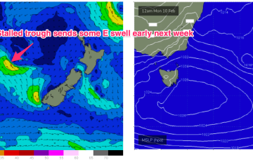
/reports/forecaster-notes/eastern-tasmania/2025/02/10/local-ely-swells-short-term-sizey-spike-in-ne
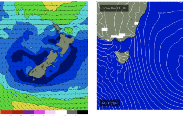
freeride76
Monday, 10 February 2025
Thursday sees a solid spike in NE windswell as N’ly winds ramp up from the South Coast across Bass Strait and adjacent to NETas.
/reports/forecaster-notes/eastern-tasmania/2025/02/07/active-period-ahead-plenty-swell-and-onshore
freeride76
Friday, 7 February 2025
Surf builds into the new week as high pressure drifts SE of the Island and the trough stalls off the Southern NSW coast, directing SE-E winds at Tas and generating some chunky E/SE-E swell.
/reports/forecaster-notes/eastern-tasmania/2025/02/05/easing-swells-the-weekend-active-period-after
freeride76
Wednesday, 5 February 2025
The next S’ly change pushes into Tas Fri before stalling, with a useful fetch of SE-E winds aimed up at East Coast Tas.
/reports/forecaster-notes/eastern-tasmania/2025/02/03/ne-windswell-peaks-tues-another-round-next-week
freeride76
Monday, 3 February 2025
A high pressure in the centre of the Tasman is directing SE-E winds across the sub-tropics, more NE in temperate regions extending down to the Island state. We’ll see more NE windswell episodes in the f/cast period.

/reports/forecaster-notes/eastern-tasmania/2025/01/31/fun-round-ne-windswell-sun-peaking-tues
freeride76
Friday, 31 January 2025
A more classic looking summer chart to start next week with high pressure in the Tasman and low pressure centres near New Caledonia and in the South Pacific slot, with a healthy E’ly tradewind fetch extending across most of the Central and Southern Coral Seas and NE winds in the NETas swell window.
/reports/forecaster-notes/eastern-tasmania/2025/01/29/small-s-pulses-and-ne-windswell-ahead
freeride76
Wednesday, 29 January 2025
As new high pressure drifts into the Tasman over the weekend we’ll see another round of NE windswell develop for NETas late in the weekend and early next week.

/reports/forecaster-notes/eastern-tasmania/2025/01/27/small-swells-the-ne-and-s-week
freeride76
Monday, 27 January 2025
NETas is likely to see at least some workable NE windswell during this period and possibly some E/NE swell of tropical origins.

/reports/forecaster-notes/eastern-tasmania/2025/01/24/weaker-windswells-ahead
Craig
Friday, 24 January 2025
The coming period is more flukey and weaker.
