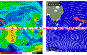
High pressure moves into the Tasman next week, setting up a broad E’ly flow, initially in the Coral Sea and then extending into the South pacific and Northern Tasman.
Primary tabs
/reports/forecaster-notes/central-queensland/2024/07/03/extended-run-surf-ahead
freeride76
Wednesday, 3 July 2024
/reports/forecaster-notes/central-queensland/2024/07/01/extended-surf-pattern-ahead
freeride76
Monday, 1 July 2024
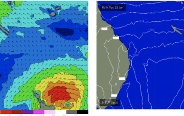
The synoptic pattern looks unseasonal with a huge, slow moving high in the Bight, expected to be reinforced by another cell to create a blocking pattern below the continent and maintain a long lasting ridge up the Eastern Seaboard this week with a healthy trade flow developing in the Coral Sea later this weekend.

/reports/forecaster-notes/central-queensland/2024/06/26/tiny-waves-just-rideable-continue
freeride76
Wednesday, 26 June 2024
There’s just enough strength in the Coral Sea trade fetch to supply some small/tiny waves on low tides into the weekend.
/reports/forecaster-notes/central-queensland/2024/06/24/couple-just-rideable-days-ahead
freeride76
Monday, 24 June 2024
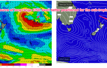
A sub-tropical low north of the North Island scooted away to the SE over the weekend and as a result the long range E/SE swell is likely to be closer to 1-2ft than 3ft with just the occ bigger set across open Burnett coast exposures.
/reports/forecaster-notes/central-queensland/2024/06/21/small-rideable-mid-next-week
freeride76
Friday, 21 June 2024
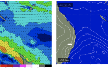
As mentioned on Wed, we should see the extended flat spell broken next week, not in spectacular fashion, but with some small, rideable days. A trough may develop in the Coral Sea, focussing E/NE winds into it, and supplying CQ with some small rideable surf.
/reports/forecaster-notes/central-queensland/2024/06/19/small-windows-opportunity-ahead-next-week
freeride76
Wednesday, 19 June 2024
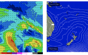
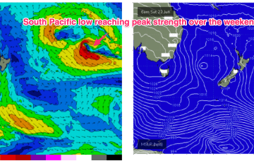
Models are also suggesting a deep sub-tropical low in Tongan longitudes right on the edge of the swell window (see below), which looks to supply some long period E/SE swell through Wed into Fri.
/reports/forecaster-notes/central-queensland/2024/06/17/winter-flat-spell continues
freeride76
Monday, 17 June 2024
No change to the outlook with low pressure in the Tasman and no swell generating winds for CQ.
/reports/forecaster-notes/central-queensland/2024/06/12/winter-flat-spell-continues-through-next-week
freeride76
Wednesday, 12 June 2024
The result will be tiny/flat surf for the CQ coast into the weekend and all of next week under current modelling.
/reports/forecaster-notes/central-queensland/2024/06/05/few-small-rideable-days-looking-tiny-surf
freeride76
Wednesday, 5 June 2024
A trough developing on Thurs/Fri should see some small E swell develop later Fri and extend into Sat.
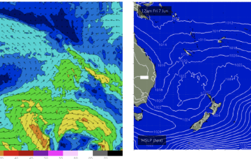
/reports/forecaster-notes/central-queensland/2024/06/03/possible-small-bump-in-size-thursfri
freeride76
Monday, 3 June 2024
There is a sliver of hope if a trough deepens off the Fraser Coast Thurs before moving south. That may see a small bump in swell later Thurs into Fri.