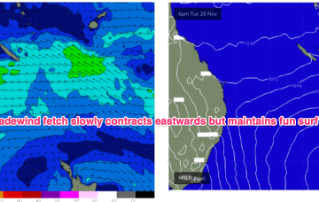
Tradewinds keep chugging away supplying fun surf over the weekend.
Primary tabs
/reports/forecaster-notes/south-east-queensland-northern-new-south-wales/2024/11/29/more-fun
freeride76
Friday, 29 November 2024
/reports/forecaster-notes/south-east-queensland-northern-new-south-wales/2024/11/27/steady-drumbeat
freeride76
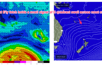
Wednesday, 27 November 2024
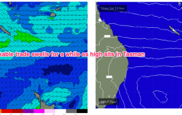
A tradewind flow focussed around the New Caledonia area and out into the South Pacific slot will maintain fun E’ly tradewind surf in the sub-tropics.
/reports/forecaster-notes/south-east-queensland-northern-new-south-wales/2024/11/25/persistent-ely
freeride76
Monday, 25 November 2024
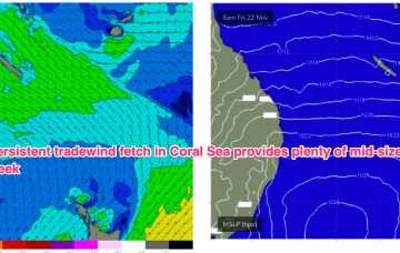
As a result, we’re looking at small NE windswells for temperate NSW, with workable trade swells for the sub-tropics and a marginal amount of that swell filtering down to temperate regions.
/reports/forecaster-notes/south-east-queensland-northern-new-south-wales/2024/11/22/workable-ely
freeride76
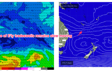
Friday, 22 November 2024
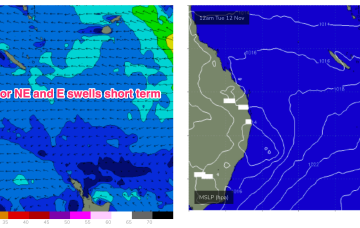
A broad but weak E'ly tradewind fetch occupies the Coral Sea, producing some workable E'ly swell.
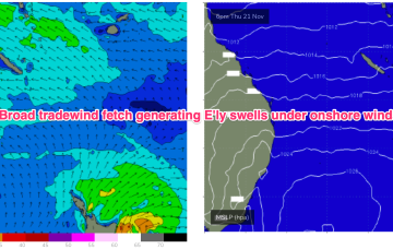
/reports/forecaster-notes/south-east-queensland-northern-new-south-wales/2024/11/20/workable
freeride76
Wednesday, 20 November 2024
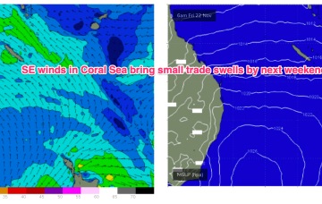
A large but not especially strong (1029 hPa) high pressure cell is west of Tasmania and slowly moving E where it enters the Tasman and becomes very slow moving. That will be the dominant feature of our synoptic set-up for some time, with a classic summer wind signal of SE winds in the sub-tropics, tending NE through temperate NSW.
/reports/forecaster-notes/south-east-queensland-northern-new-south-wales/2024/11/18/onshore-pattern
freeride76
Monday, 18 November 2024
Tradewinds will supply workable swells for the sub-tropics medium term with small pulses of S swell this week favouring NSW.
/reports/forecaster-notes/south-east-queensland-northern-new-south-wales/2024/11/15/nothing-major
freeride76
Friday, 15 November 2024
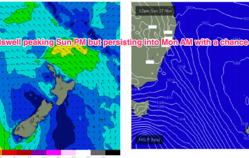
We’ll see the NE flow ramp up on Sun across the MNC, grading lighter the further north you go, as an approaching front and cut-off low really tightens the pressure gradient.
/reports/forecaster-notes/south-east-queensland-northern-new-south-wales/2024/11/13/small-and-weak
freeride76
Wednesday, 13 November 2024
Troughiness next week does offer potential for low pressure development in the Tasman but we’ve got high model variability so confidence is very low in the outcomes.
/reports/forecaster-notes/south-east-queensland-northern-new-south-wales/2024/11/11/more-small-low
freeride76
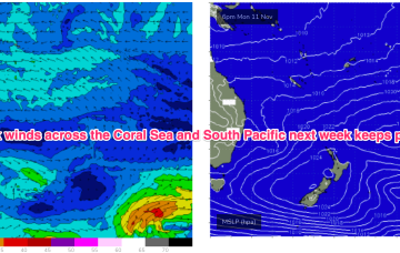
Monday, 11 November 2024
Another unstable, troughy week ahead with humid, unstable air over the continent creating a series of troughs, one of which forms a slow moving trough of low pressure off the Mid North Coast which interacts with a weak high pressure cell drifting in the Tasman.
/reports/forecaster-notes/south-east-queensland-northern-new-south-wales/2024/11/07/flukey-s-swell
freeride76
Friday, 8 November 2024
No change to the surf outlook over the weekend which remains small and weak but winds will be all over the place as a trough of low pressure hovers about the NSW North Coast.