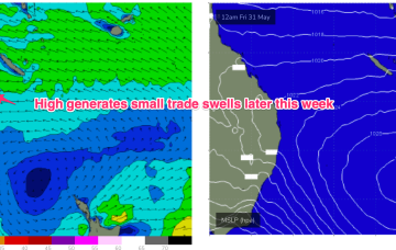
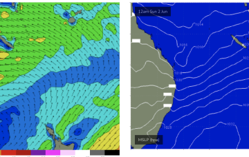
There is a sliver of hope if a trough deepens off the Fraser Coast Thurs before moving south. That may see a small bump in swell later Thurs into Fri.
Primary tabs
/reports/forecaster-notes/central-queensland/2024/06/03/possible-small-bump-in-size-thursfri
freeride76
Monday, 3 June 2024
/reports/forecaster-notes/central-queensland/2024/05/29/plenty-fun-days-ahead-the-weekend-becoming
freeride76
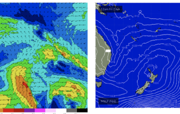
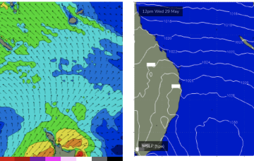
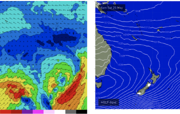
Wednesday, 29 May 2024
The high is generating E’ly tradewinds in the Coral Sea with a fun sized surf running across CQ and expected to last into the weekend.
/reports/forecaster-notes/central-queensland/2024/05/27/rideable-every-day-small-boost-later-in-the
freeride76
Monday, 27 May 2024
Tradewinds in the Coral Sea generate small swells this week and through the second half of the week we should see a small boost in size as the fetch migrates southwards and squares up more SE of New Caledonia.
/reports/forecaster-notes/central-queensland/2024/05/24/small-waves-weekend-next-week-looking-better
freeride76
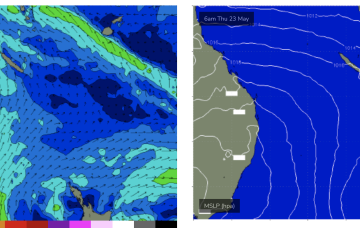
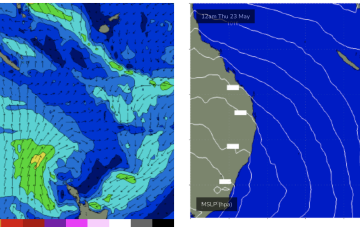
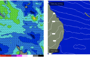
Friday, 24 May 2024
By Thurs we should start seeing slightly bigger E’ly tradeswell from a fetch developing next week in the Coral Sea.
/reports/forecaster-notes/central-queensland/2024/05/22/small-waves-week-next-week-looking-better-now
freeride76
Wednesday, 22 May 2024
Another reinforcing high cell moves in from the Bight later this week, with a rebuild in SE winds better placed for swell generation in CQ.
/reports/forecaster-notes/central-queensland/2024/05/20/few-small-waves-week-trade-flows-slowly
freeride76
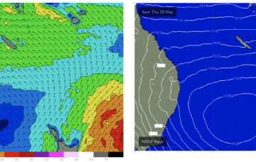
Monday, 20 May 2024
CQ will see another slight build in fun SE-E/SE swell from mid week as SE winds rebuild in the Coral Sea.
/reports/forecaster-notes/central-queensland/2024/05/17/easing-sat-few-small-days-it-builds-again
freeride76
Friday, 17 May 2024
A trough in the jet stream and low in the Tasman will disrupt this flow and we’ll see a few tiny days as a result early next week.
/reports/forecaster-notes/central-queensland/2024/05/15/rideable-the-rest-the-week-brief-quiet-spell
freeride76
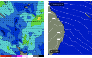
Wednesday, 15 May 2024
That will see SE winds for sub-tropical areas with a small, building trade swell to ride.
/reports/forecaster-notes/central-queensland/2024/05/13/ups-and-downs-generally-positive-outlook
freeride76
Monday, 13 May 2024
We’ll see some small SE swell as the new high pressure ridge builds windfield in the Coral Sea and Northern Tasman but this will be smaller and weaker than previous swells of this ilk.
/reports/forecaster-notes/central-queensland/2024/05/10/rideable-waves-over-the-weekend-more-later
freeride76
Friday, 10 May 2024
A broad windfield in the Coral Sea is maintaining fun waves and this pattern will extend over the weekend.