Red menace heading towards Europe

Less than a week after the recent groundbreaking XXL swell smashed into Europe, a second XXL swell is on target for the region.
It's very early in the season for storms of this intensity to be forming in the Atlantic Ocean, but even more unusual is the strength in which the weather systems are maintaining as they head towards Europe.
At this time of year it's more common to see hurricanes forming in the tropics and following the Gulf Stream up the North American coast before re-curving into the North Atlantic Ocean.
The last two weather systems have instead formed in the Greenland Sea and rather than weakening while approaching Europe, they have in fact strengthened, typical of winter not autumn.
Sunday's XXL swell which saw some of the largest waves ever ridden in Nazare, Portugal, was aimed more towards Southern Europe, but this second system will be positioned further north and focus all of its energy into Ireland and Scotland.
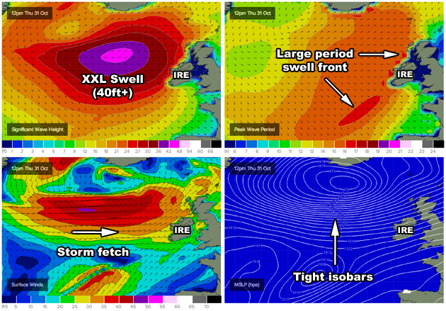
Click through above to view the Irish wave charts
More specifically, a broad and intense low stalling over the Greenland Sea will generate a persistent fetch of severe-gale to storm-force westerly winds aimed towards Ireland and Scotland, with stronger hurricane-force winds expected at the peak of the storm. The weather system as a whole will move slowly towards Northern Europe, before skirting the top of Ireland and pushing across Scotland through Friday.
With it will come an XXL westerly swell, with the notorious left at Mullaghmore Head forecast to be in the 25ft range Friday morning. More exposed coasts should pick up 30ft sets, but it will be the more protected novelty beaks across Ireland and Scotland that are set to fire.
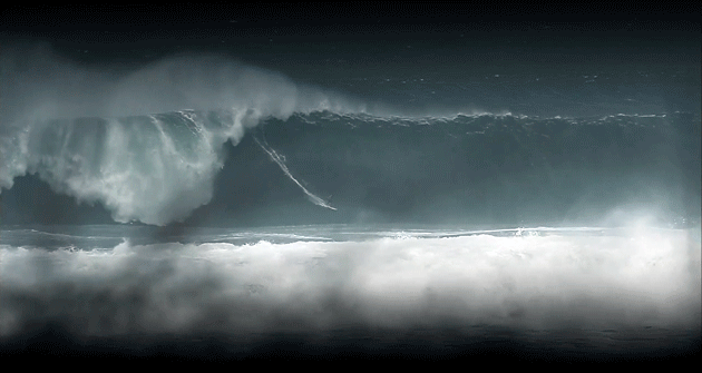
Click through above to view a video of Mullaghmore from last winter "Fathoms Left to Fall"
Nazare will also see large waves from Friday through Sunday filtering down from the North Atlantic but it's not expected to reach the size seen a few days ago.
Keep track of the storm and swell forecasts for Ireland and Scotland below, and remember to click the WAMs tab to get an idea on the enormity of the weather system:
http://www.swellnet.com/reports/ireland
http://www.swellnet.com/reports/scotland
Video credit: Fathoms Left to Fall - A Northcore Film
Comments
Frothing to see some novelty beaks, with halloween and all!
nice photos!
will maya give it another go?