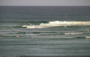
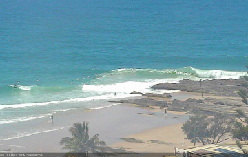
Small windows of clean waves on the beaches
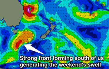
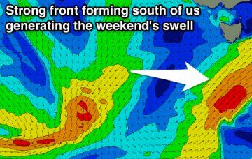
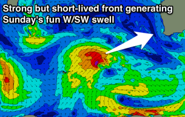
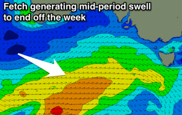
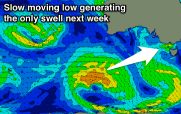
Not the best forecast period ahead with small weak swells and only a couple of good windows of decent surf on the beaches.
Small end to this week and the weekend but there is finally a change in the weather patterns and swell due from next week. Micronesia and PNG will see swell off Typhoon Wutip.
To be honest, SE Qld and Far Northern NSW coasts simply aren’t conditioned for swell events of this magnitude. More in the Forecaster Notes.
Of course, TC Oma is the only weather system on the synoptics of interest to us. But, it's not the primary swell source for Southern NSW this forecast period. More in the Forecaster Notes.
A fun SE groundswell to end the week mixed in with a flukey building N/NE cyclone swell and good S'ly pulse again Sunday.
Mix of W/SW and SE swell for Friday with a good S'ly swell on the weekend.
Average conditions with a good swell tomorrow, with a slight window Friday but better surf from Sunday with a fun W/SW swell.
A fun mid-period swell for the end of the week but a stubborn high will bring average winds, slowly improving over the weekend as the swell fades.
Make the most of the current conditions as winds will go onshore from tomorrow and improve later in the weekend.
On Sunday evening, the world’s leading atmospheric model (ECMWF) bucked the trend: keeping TC Oma off the SE Qld coast for a few days and then actually tracking it north, ahead of a coastal crossing mid-next week.