On the cusp of an extended run of easterly swell
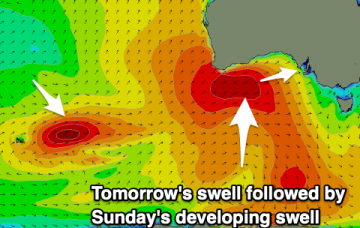
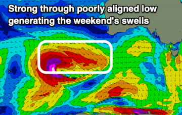
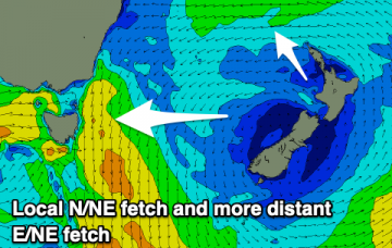
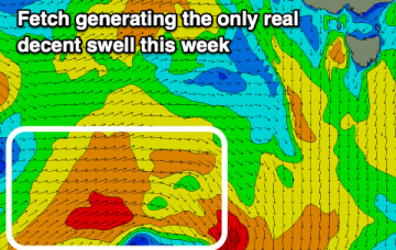
Looks like a steady round of punchy trade swell ahead. More in the Forecaster Notes.
A mix of swells from the north-east and south with favourable winds over the coming period.
We've got a slow upwards trend out of the E/NE from our developing trade flow in the northern Tasman Sea. And maybe a small S'ly swell too. More in the Forecaster Notes.
A new W/SW swell to end off the week with a fun S/SE swell for the weekend.
Plenty more surf on the way with back to back large swells and workable winds.
A large W/SW groundswell and great winds for the Mid, improving down South Friday. Good swells again from Sunday with varying winds.
Tricky though plenty of westerly swell on the way with winds clocking a full 360 around the compass.
Plenty of swell out of the N/NE and E/NE over the coming period and with workable winds.
Our Easter swell is being generated by a broadening E’ly fetch atop a large, stationary Tasman high, that’s expected to remain slow moving inside our swell window up until the weekend. More in the Forecaster Notes.
A generally tiny run of swell with one day standing out to offer the most surfable waves.