Yeah, nah: 'tis a pretty uninspiring outlook
Wednesday, 20 October 2021
Yeah, nah: 'tis a pretty uninspiring outlook
Wednesday, 20 October 2021
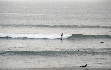
There’s not a lot of juice left in the tank.
There’s not a lot of juice left in the tank.
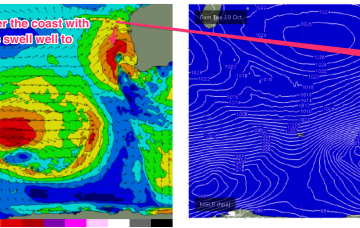
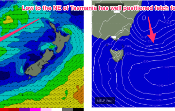
Current ASCAT (satellite windspeed) passes show a broad fetch of E to ESE’ly winds feeding into the small low east of Tasmania, with another weak low centre off the NSW Mid North Coast also providing a weak E’ly fetch.
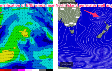
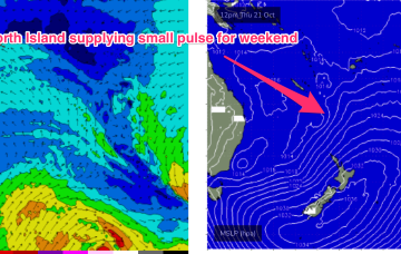
These swell trains are generated as a deep, angled trough through the area between the North Island and New Caledonia merges with the remnants of the Tasman low and focusses E to ENE winds in a broad area near the North Island during Friday.
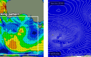
The interplay between the two systems is producing a fetch of E/SE winds through the Central Tasman, in effect a sub-tropical looking tradewind style fetch we might see in Summer.
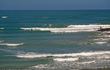
Forecast data looks uninspiring for the rest of this week, but we should see small leftover waves for the next few days thanks to a trailing polar low/front below the state yesterday that’s generating some minor S/SW swell for our region.
Wednesday looks to be the pick of the forecast period down south. The Mid has good options lining up for the weekend.
The first blast tomorrow will be increasing N/NW windswell, with increasing N’ly winds tending NW through the a’noon and potentially becoming gale force, especially on the Bunbury to Perth stretch.
Easing swells are expected from Tuesday onwards, but the main issue we have for the short term - at least, west of Melbourne - is a developing south-easterly airstream on Tuesday that’ll veer gusty easterly into Wednesday.
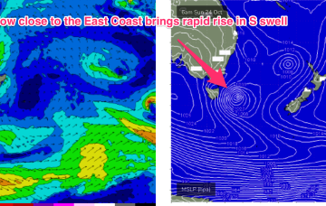
A trough in the Tasman off the NSW coast deepens into a small, surface low through Tuesday. Compared to model runs on Friday, this slow moving low is now positioned further south, in a more favourable position for swell generation for the East Coast of Tas.
From tomorrow we see a large, southwards located high and multiple troughs located in the Tasman sea and inland become the dominant synoptic features for the week. This is going to set-up some tricky, short-lived fetches as well as another week of multiple wind changes.