Mostly tiny swells with varying winds
Friday, 5 November 2021
Mostly tiny swells with varying winds
Friday, 5 November 2021
Not much in the way of size over the coming period and with funky winds owing to troughy weather.
Not much in the way of size over the coming period and with funky winds owing to troughy weather.
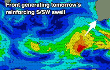
The fetch out of Cook Strait, extending up past Taranaki Peninsula and into the Tasman sea looked good on ASCAT (satellite windspeed) passes through Wed/Thurs, with areas of storm force winds embedded in a long fetch of severe gales to low end gales. With the buoys and observations already confirming the swell it’s only local winds we’ll be concerned with.
There's a good swell due tomorrow with favourable winds, and it's worth making the most of before the outlooks quietens down from next week.
The fetch out of Cook Strait, extending up past Taranaki Peninsula and into the Tasman sea looked good on ASCAT (satellite windspeed) passes through Wed/Thurs, with areas of storm force winds embedded in a long fetch of severe gales to low end gales. With the buoys and observations already confirming the swell it’s only local winds we’ll be concerned with this weekend.
Make the most of today and the coming windows of waves as the outlook from mid-late next week is generally poor.
A great day of waves for the beaches tomorrow with windows early-mid next week across both regions before entering an average period.
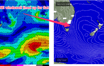
This sees the next round of NE windswell building through Sat as the N’ly fetch freshens adjacent to the Island and extends up the Far South Coast during the day.
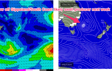
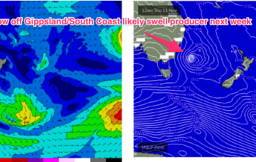
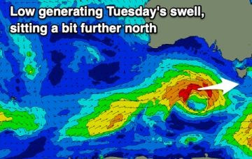
The good news for our surf prospects is a complex low pressure system located just NE of the North Island is strong enough and large enough to generate severe gales to low end storm force SE/ESE winds out of Cook Strait, adjacent to the Taranaki peninsula and extending out into the Eastern Tasman sea.
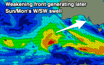
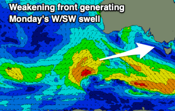
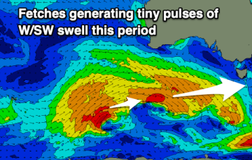
There's a steady supply of tiny W/SW swell on the way but winds are tricky. A fun new swell is due early next week.
Current ASCAT (satellite wind speed) passes show areas of the fetch already at storm force strength as it develops in the areas mentioned above, leading to high confidence in the upcoming f/cast.