Quiet week ahead with swell sources for the weekend
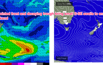
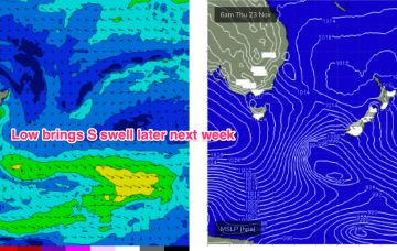
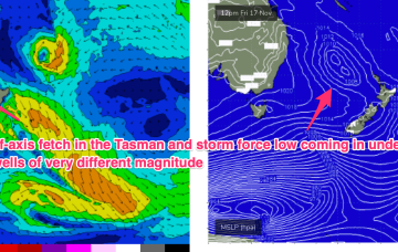
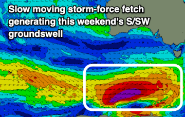
Into the weekend and we should see an increase in NE-E/NE swell on Sat from winds feeding into a trough near the Gippsland coast.
The troughy pattern remains installed into the medium term so we’re still keeping an eye out for short range features which could supply local swell sources, although these look small and weak.
The period remains average with small swells with strong winds which will limit options.
The troughy pattern remains installed into the medium term so we’re still keeping an eye out for short range features which could supply local swell sources.
The coming fortnight looks average with persistent onshore winds from the southern quadrant. A couple of small windows might present themselves.
The current strong swell will ease today, with smaller, weaker swells with deteriorating winds and conditions due this period. There should be a couple of windows to the east.
Into next week and a large blocking high moving into the Tasman over the weekend is now weaker than expected and the resultant trade flow through the Coral Sea is also much weaker.
Therefore we’re now only looking at tiny surf for next week
Sun is a different story as strong, long period S swells from a storm force system in the Southern Ocean make landfall.
In the mix will be some inconsistent E swell from TC Mal’s run through the swell window. It accelerated as it hit the swell window so a slight winding back in size is justified but we’ll still see some defined sets in the 3 occ. 4ft range through Sat morning, easing during the day.
A trough will bring funky winds when a large S/SW groundswell peaks this weekend.