Fun surf from Sunday working the morning winds
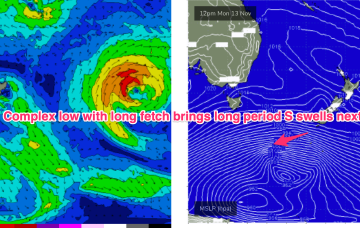
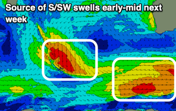
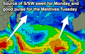
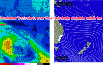
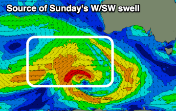
Tomorrow looks tiny, but some good swell is due from Sunday and more so next week though with tricky winds.
Much stronger frontal activity in the Far Southern Tasman tied to a deep, slow moving low will provide long period S’ly groundswell pulses next week, although winds are looking very tricky around a weak, troughy pattern.
Today's building swell will ease slowly tomorrow, further Sunday under strong morning offshore winds. Next week looks slower but fun up until Wednesday.
Winds will be onshore for most of the period down South so make the most of this morning. The Mid Coast looks fun with a few standout days.
The run of favourable surf on the exposed beaches will come to an end on the weekend, with building swell and workable winds for protected spots due from Sunday.
We've got a slight upgrade of the best swell for the period.
No great change to the f/cast. A large (1030hPa) high near New Zealand is continuing to direct tradewinds through the Coral Sea, with the New Caledonia region being the strongest wind area.
A small bump in swell today will fade into the end of the week, while next week looks active with back to back solid swells.
A weak ridge up the sub-tropics has a lighter E’ly flow with stronger N-NE winds south of the MNC down to the South Coast and Tasmania. We’ll see this pattern persist with increasing NE windswell across NE Tas this week. A strong frontal progression is expected to provide a series of S swells next week.
The swell producing low is looking healthy and should produce a good pulse of swell.