Large swells inbound with workable winds
Monday, 8 April 2024
Large swells inbound with workable winds
Monday, 8 April 2024
The coming period is very active thanks to a strong node of the LWT firing up just east of us.
The coming period is very active thanks to a strong node of the LWT firing up just east of us.
A high E of NZ is feeding winds into a trough in the Coral Sea and that will hold fun surf today and into tomorrow.
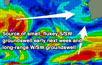
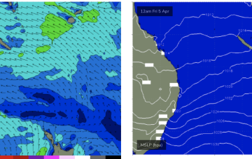
Strong frontal activity to the south tied to slow moving and complex polar lows is better aimed at NZ and South Pacific targets but plenty of refraction and sideband southerly energy is expected to make landfall in addition to the Tasman low swell this week and into the weekend.
Make the most of the swell due into tomorrow morning with a slower outlook due until later next week.
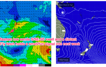
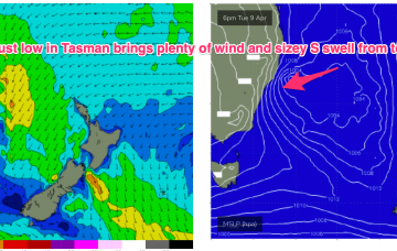
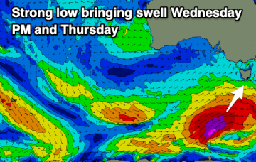
That’s allowing plenty of space for low pressure development in the Tasman and as a front pushes through and combines with the remnants of a trough we’ll see a robust low develop through tomorrow, with gales expected close to the coast.
There should be plenty of surf days to work around this period, with the South Coast being the pick.
That’s allowing plenty of space for low pressure development in the Tasman and as a front pushes through and combines with the remnants of a trough we’ll see a robust low develop through tomorrow, with gales expected close to the coast.
There's a ton of swell inbound, but with us falling on the backside of the LWT, winds won't be especially favourable.
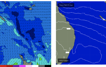
We’ve got large peanut shaped high centred over Tasmania with lobes in the Bight and Tasman Sea. The moist onshore flow from this set-up is flowing into a coastal trough and small trough of low pressure off the NQLD coast bringing fun sized E swell.
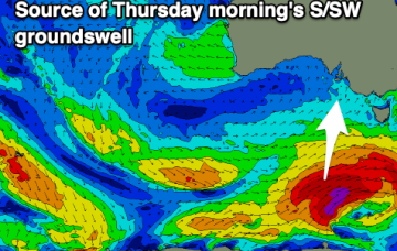
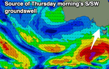
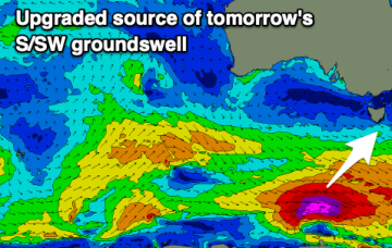
We've got an upgrade in tomorrow's groundswell, with plenty more large surf to come mid-late next week onwards.