Mediocre period of swell ahead
Monday, 1 April 2024
Mediocre period of swell ahead
Monday, 1 April 2024
The coming period looks sub-par swell wise with nothing of significance due.
The coming period looks sub-par swell wise with nothing of significance due.
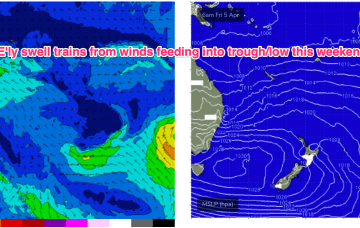
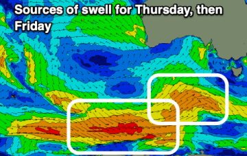
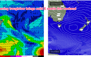
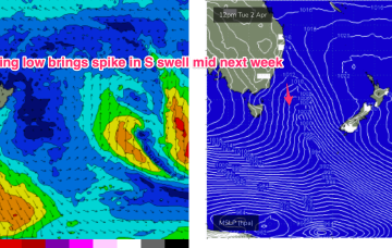
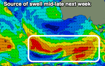
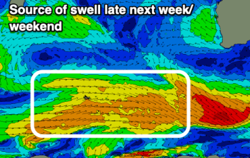
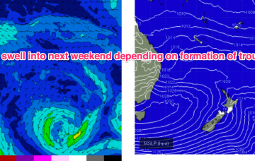
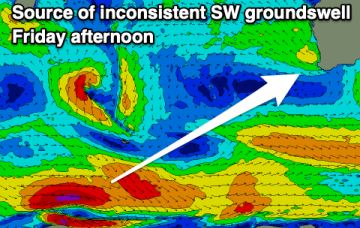
A complex inland trough low tied to tropical sources exits the coast as a strong high moves into the Bight. Following that a coastal trough in the Northern Tasman then deepens, likely into a surface low which may drift southwards bringing E swells to the entire region, possibly followed by a return S swell as the low gets captured by an approaching front.
The coming week is mostly average but there are a couple of windows to work around.
The coming period is generally poor, only improving later in the weekend, with better potential next week.
A complex inland trough low tied to tropical sources exits the coast as a strong high moves into the Bight. Following that a coastal trough in the Northern Tasman then deepens, likely into a surface low which may drift southwards bringing strong E swells to the entire region, possibly followed by a return S swell as the low gets captured by an approaching front.
High pressure in the Tasman is maintaining a ridge along the QLD coast with fun sized surf across the CQ region under mod/fresh SE winds.
It’s quite a bland synoptic outlook with a large area of high pressure moving into the Tasman and becoming slow moving as it weakens. That is forcing fronts well to the south and away from the southern swell window. Not much change for the Easter outlook. Just tiny surf is expected both days and extending into Easter Mon.
Take your pick this period working the tides and winds for the best of the coming swell.
Conditions should be cleaner tomorrow morning thanks to an improved wind outlook with a peak in large W/SW swells.
Only minor action from the E is expected from a northwards positioned SE flow in the Coral Sea. Adding to that source south of the border we’ll see some small S’ly pulses over the Easter long weekend.