Best early next week across the South Coast
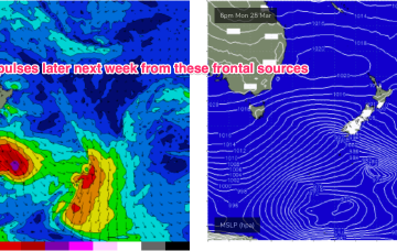
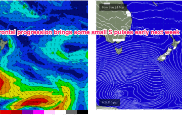
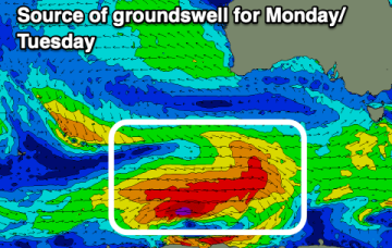
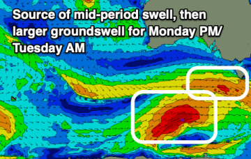
The Mid Coast will lose its size on the weekend and the South Coast will be onshore. Better swells with light winds are due early next week.
Light winds continue into Mon and likely until Wed as the as the W-E progression of the next high cell (and subsequently fronts) slows and allows more intrusion of the S’ly fronts into the lower Tasman. S swells from frontal activity now look a notch more active next week, especially at S facing beaches in NENSW.
S swells from frontal activity now look a notch more active next week as the W-E progression of the next high cell (and subsequently fronts) slows and allows more intrusion into the lower Tasman.
The coming period is very active with an improved wind outlook for the Surf Coast.
Easing surf over the coming days, with larger energy due into the end of the month.
Into next week and we’ll see a new high pressure system set up a SE surge as we move into the Easter weekend.
We’ll see some frontal activity over the weekend and S pulses next week before another strong, blocking high sets up a ridge next week.
An active and strengthening progression of cold fronts and a final low will bring plenty of swell along with favourable winds.
The NZ high and a long monsoon trough has generated a useful fetch of tradewinds in the eastern swell window, which has maintained E’ly swells in the sub-tropics, E/NE in temperate regions.
A good swell is due Friday and Saturday morning, then slow ahead of more action later next week/weekend.