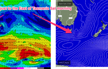
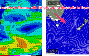
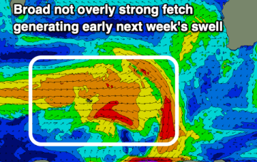
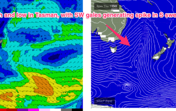
Mixed swells and conditions but there are a few windows
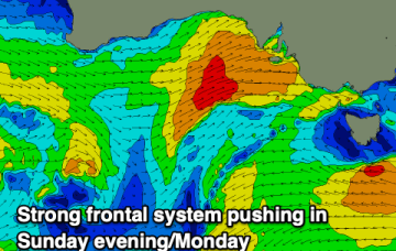
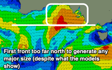
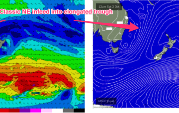
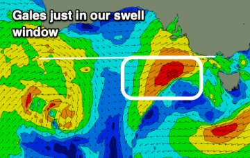
Keep your expectations low regarding tomorrow and pick the windows of cleaner conditions.
A slow moving low with multiple embedded troughs will produce a long live SE swell through the coming period.
An inland low and offshore trough are generating a mix of NE winds and more proximate E’ly winds both in the Eastern Tas swell window. Onshore winds have been associated with the approaching low.
Nonetheless, there’s a nicely aimed fetch of ENE/NE strong winds located in the Northern Tasman sea into sub-tropical latitudes and a more distant tradewind fetch out near New Caledonia.
Nowhere to recommend this weekend with poor conditions, better into next week but mostly north of Margs. There's a large swell due late week.
A trough and inland low located over Victoria is now in the process of moving offshore, shunting the N’ly winds further East and bringing a regime of more variable, tending W’ly winds.
A window of fun waves tomorrow before winds start strengthening Sunday ahead of a cold front Monday and solid, stormy swell.
A mixed period with today and later next week providing the most reliable swell. In between we're looking at a flukey period early next week.
Still on track for some large, windy surf for the NE coast as an approaching low pressure system focusses an infeed of E’ly winds onto the coast and an associated NE fetch in the Tasman, adjacent to the NSW coast sends NE swell towards Tasmania.
Weekend is still looking good, with NE/ENE swell being generated by the slow moving fetch feeding into the trough, extending out towards New Caledonia and a basically W’ly wind pattern.