Tiny to flat period
Friday, 8 October 2021
Tiny to flat period
Friday, 8 October 2021
The storm track isn't favourable at all for our region. Try the East Coast Forecaster Notes.
The storm track isn't favourable at all for our region. Try the East Coast Forecaster Notes.
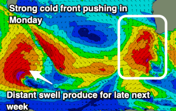
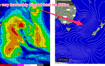
A much more solid swell event then unfolds through the second half of next week , with a high pressure system drifting in the lower Tasman towards the South Island and a strong N’ly fetch developing off the back of the high, with pressure gradients being tightened by an approaching mid-latitude low in the Bight.
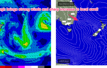
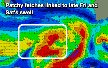
Highly dynamic week next week kicks off Mon with a NE/SW angled trough expected to form offshore from the top of the Hunter coast, or lower Mid North Coast. That will see strong S’ly quarter winds work their way North through Mon.
There's lots of swell still on the cards for this period but it's dealing with the local winds which is the main issue.
Highly dynamic week next week kicks off Mon with a NE/SW angled trough expected to form offshore from the top of the Hunter coast, or lower Mid North Coast.
Good waves on the South Coast over the coming 24 hours before winds deteriorate and some fun W/SW swell fills in as winds favour the Mid Coast.
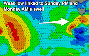
Make the most of the current surf as we'll see smaller waves into tomorrow, with poor conditions Sunday/Monday along with a new mix of swells.
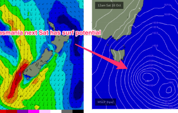
Things get more interesting next week, as instability in the Tasman sea leads to some surf potential for the East coast of Tas.
There's not much to extract from the coming forecast period. Try the East Coast Forecaster Notes.
Plenty of options for a surf as we head deeper into spring across the state.