XL swell on the build

Western Australian Surf Forecast by Craig Brokensha (issued Monday May 27th)
Best Days: Today, tomorrow and Thursday morning Perth and Mandurah
Features of the Forecast (tl;dr)
- XL swell filling in today with variable winds in the South West, increasing from the N/NW to the north
- Easing swell tomorrow with strengthening W winds, light E/NE to the north until early PM
- Stormy large swell Wed with strong to near gale-force W/SW tending SW winds
- Easing swell Thu with gusty SW winds (light E/NE to the north)
- Smaller Fri with strengthening N/NW winds, N/NE early to the north
- Large to exra-large swell building over the weekend with strong N/NE-N/NW winds Sat, NW Sun
Recap
The weekend saw building levels of westerly swell but with generally poor conditions yesterday, better across selected breaks in the metro regions yesterday with winds from the north-eastern quadrant. This created fun options with surf to 2-3ft.
A larger swell kicked into the afternoon yesterday and has held this morning with waves more to 3ft in Mandurah, still 2-3ft in Perth and 10ft+ across the South West with a bit of south in the wind. This has opened up options inside protected spots.
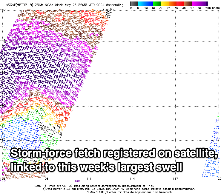
A more significant XL pulse is now filling in, generated by a significant low that form directly off the coast on the weekend. Storm-force winds should see the swell kick to an easy 15ft across the South West, 4ft Mandurah and 3ft Perth along with variable winds across Margs, tending more N/NW to the north.

XL swell clean in protected corners
This week and weekend (May 28 - Jun 2)
This afternoon’s XL swell is due to ease through tomorrow and the next approaching frontal system, will bring strengthening W’ly winds across all locations, though Perth and Mandurah are due to see light E/NE winds all morning, deteriorating into the afternoon.
Great sets easing from 4ft are due around Mandurah and 3ft in Perth, with Wednesday seeing a localised increase in stormy swell as the next approaching front forms into a mid-latitude low.
Strong to possibly gale-force SW winds will kick up some local stormy swell but with those strong to possibly gale-force W/SW tending SW winds.
Winds are due to abate into Thursday though persist from the SW across Margs, with lighter offshore winds to the north.
We’ll be looking at easing surf from 10ft or so in the South West, 3ft Mandurah and 2-3ft Perth.
Unfortunately there’s no let up in the wind as the next swell producer starts moving in Friday, bringing strengthening N/NW winds.
This looks to be another significant mid-latitude frontal progression, generating more large to extra-large surf through the weekend but with winds from the north-western quadrant, possibly improving temporarily early next week. More on this Wednesday.
Comments
Latest notes are live.
Witnessed some incredible stuff today.
The Right??
Crazy shit!