Average Saturday, great Sunday, Monday, Wednesday

Western Australia Surf Forecast by Craig Brokensha (issued Friday 10th October)
Best Days: Late Saturday in the South West, Sunday morning, Monday morning, Tuesday morning, Wednesday morning Thursday morning
Recap
Margs was average again yesterday as well as Mandurah, but Perth and Gero offered better conditions through the morning with a small swell and offshore winds.
Today Margs saw a more variable S'ly winds creating lumpy and workable waves, while conditions improved through the morning with a light S/SE'ly but Gero was the pick with light SE winds and a fun 3-4ft of swell. A long-range and inconsistent SW groundswell from the south-east of South Africa has since built across the coast but winds are now onshore.
This weekend (Oct 11 - 12)
There's been no real change to the large SW groundswell expected to fill in tomorrow across the state, generated by a vigorous polar frontal progression to our south-west over the last few days.
This swell should reach 10ft+ in the South West tomorrow afternoon, 3ft+ in Perth and 6ft+ late around Gero (holding a similar size Sunday morning as all other coasts ease away).
Winds will be poor around Margs tomorrow with a fresh W/SW breeze but a late S/SW change should open up protected locations into the evening. Further north conditions won't be too flash with S/SE tending S/SW winds.
Sunday is the day to surf with winds swinging around to the E/SE across Margs and Perth, with SE winds up at Gero. The South West should ease from 8-10ft, 3ft in Perth and 6ft+ up around Gero.
Next Monday onwards (Oct 13 onwards)
 Monday looks excellent still with winds swinging around to the E/NE across most locations during the morning as the swell continues to ease.
A low point in swell activity is due Tuesday morning and winds are due to swing back to the SE in the South West as favourable E'ly winds persist further north.
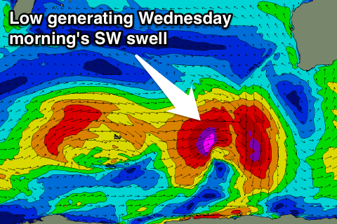
A good new pulse of SW groundswell is due into Tuesday afternoon, peaking Wednesday though, generated by a vigorous low pressure system moving in from above the Heard Island region, projecting a fetch of severe-gale W/SW winds through our swell window.
This swell should peak in the 6ft+ range around Margs, 2ft in Perth and 3-4ft+ up at Gero with favourable offshore E/SE winds.
After this another slightly smaller SW groundswell is due Friday but with unfavourable winds. We'll look at this again Monday though. Have a great weekend!