Plenty of swell, tricky winds
Monday, 31 October 2022
Plenty of swell, tricky winds
Monday, 31 October 2022
There's no lack of swell inbound, with good windows for the savvy to work around wind wise.
There's no lack of swell inbound, with good windows for the savvy to work around wind wise.
Easing surf over the coming days ahead of some new SW groundswell energy through the end of the week. Slowly improving winds before going onshore Friday.
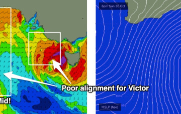
While we won’t get the full payload of S’ly swell from this system as the system gets shunted SW as it enters the swell window (NE would be ideal!) we’re still on track for a few usable S swell pulses this week mostly south of the border, with a trailing frontal system providing bigger S swell into and over the weekend.
There'll be no issue with swell over the coming period, though winds will spoil conditions until later week but more so the weekend.
While we won’t get the full payload of S’ly swell from this system as the system gets shunted SW as it enters the swell window (NE would be ideal!) we’re still on track for a few usable S swell pulses this week, with a trailing frontal system providing bigger S swell into and over the weekend.
There's plenty of swell due this coming period but not to any major size and with tricky winds.
This is looking like a hallmark winter pattern, with four days of westerly gales
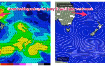
An amplifying Long Wave Trough over the southern states will drive a series of powerful fronts through the Bight throughout next week.
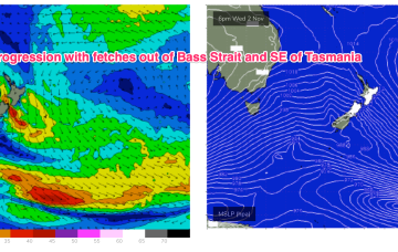
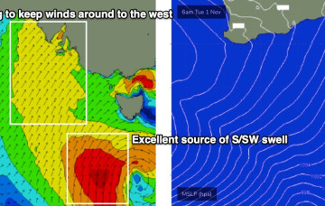
Get in early Sat as SE winds blow as an embedded low drifts down from the Central West. Once that system moves E we’ll see fresh S’ly winds set in.
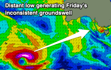
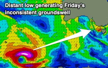
Into next week and a quick spike in NE windswell is expected Mon AM into Tues AM as another mid-latitude low approaches from the Bight and tightens the pressure gradient with the high in the Tasman.