Window of funky waves tomorrow
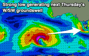
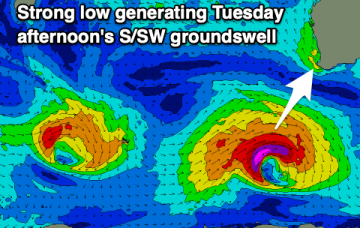
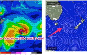
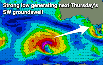
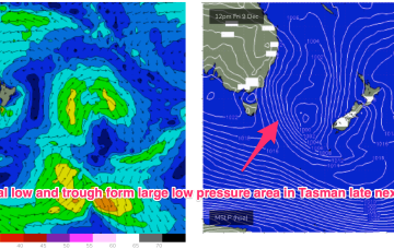
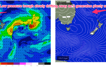
The outlook is generally average with dicey winds spoiling a variety of swells. There should be a few windows to pick out from the period though.
No great change to the weekend f/cast. A high is approaching Tasmania from the W, passing over the state tonight and setting up N’ly winds Sat before a trough brings a more variable SE-SW flow on Sunday.
Get a surf in tomorrow morning before the swell fades. Next week looks active but mostly onshore.
A slow moving low pressure system is currently off the QLD coast generating plenty of size for the subtropics. Windspeeds along the southern flank are just a notch higher than modelled on Wed so we’ve seen a corresponding uptick in size.
The coming period looks to see swells peaking more so into the afternoons when winds are less favourable.
Make the most of tomorrow morning before the swell fades and becomes tiny Sunday. Most of next week will be poor before improving later in the period.
A slow moving low pressure system is currently off the QLD coast generating plenty of size for the subtropics. Windspeeds along the southern flank are just a notch higher than modelled on Wed so we’ll see a corresponding uptick in size across the f/cast region as swell radiates away from the source fetch.
The exposed beaches will be fun all weekend but becoming smaller and slower into Sunday. We've got an average start to next week, ahead of a good swell Thursday.
We are seeing the “schizoid” pattern now develop whereby a monsoonal trough is splitting off a low pressure trough along the CQ coast, supported by a high pressure belt from the Bight to the Tasman Sea, while fronts and a parent low are entering the lower Tasman. That is seeing a regime where both S swells and a developing E’ly swell event are both in play across most of the Eastern Seaboard. S’ly swells are dominating the Southern Tasmanian coast, with a small wrap around into the North-East coast.
We are seeing the “schizoid” pattern now develop whereby a monsoonal trough is splitting off a low pressure trough along the CQ coast, supported by a high pressure belt from the Bight to the Tasman Sea, while fronts and a parent low are entering the lower Tasman. That is seeing a regime where both S swells and a developing E’ly swell event are both in play across most of the Eastern Seaboard.