Average surf, improving from Sunday
Wednesday, 23 November 2022
Average surf, improving from Sunday
Wednesday, 23 November 2022
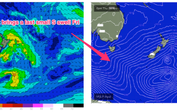
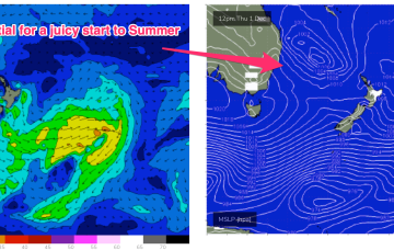
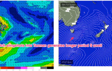
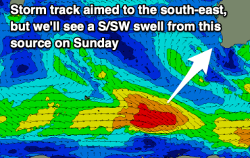
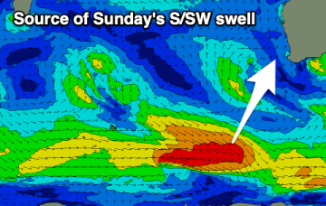
Poor winds and weak swells to end the week and start the weekend. We should see better surf developing from Sunday and into next week.