Tricky options early next week
Friday, 3 March 2023
Tricky options early next week
Friday, 3 March 2023
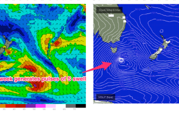
New swell due early next week will have a lot of south in it.
New swell due early next week will have a lot of south in it.
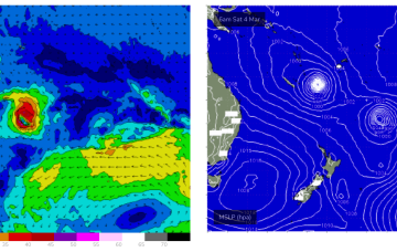
A weak ridge from a high (1023hPa) tracking towards Tasmania supplies light winds tomorrow while TC Judy and Kevin both race away to the SE, supplying very little surf to the region.
Through Sun we’ll see increasing NE-N winds, along with a vey well aimed fetch of NE winds off the Gippsland to Bass Strait stretch whipping up NE windswell.
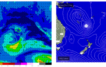
Good winds with fun surf for the weekend, windy and building through next week.
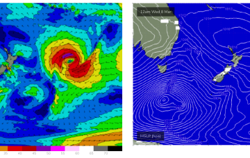
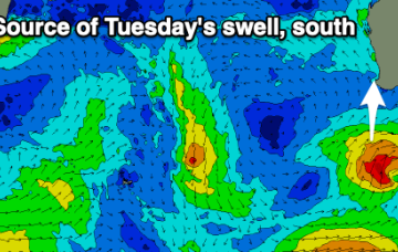
We may see a small amount of longer period E’ly energy as TC Judy briefly slows in the swell window. Nothing major, just a few 3ft sets. TC Kevin is now following the same path as TC Judy with just traces of E/NE-E energy added into the mix Sun/Mon.
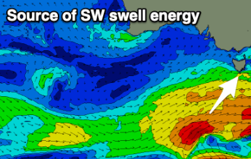
A weak ridge from a high (1023hPa) tracking towards Tasmania supplies weak breezes tomorrow, likely SW inshore early before tending light SE-NE through the day. A continuing mix of S swells, mostly mid period from the frontal progression below Australia supplies some 2-3ft surf at S swell magnets, smaller elsewhere.
Improving conditions through the weekend though with plenty of size, bigger and windier next week, with quality waves in protected spots.
The tropics remains active with a monsoon trough and convective activity strewn across the Top End, while the edge of the trough in the South Pacific has spawned TC Judy, with another system behind it. Both of those systems are now modelled to track quickly SE through the swell window with no major swells generated.
Further south a deep polar low and frontal system is generating large swells, with traces of long period S swell refracting back into Eastern Tas over the coming days. A weak, troughy pattern is NE of Tas now with a high pressure system expected to drift over the state through Fri.
Building surf over the coming days, cleanest tomorrow morning and fun on the weekend.