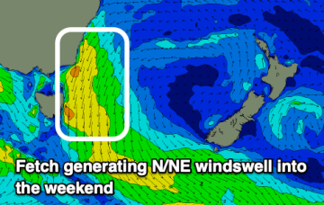
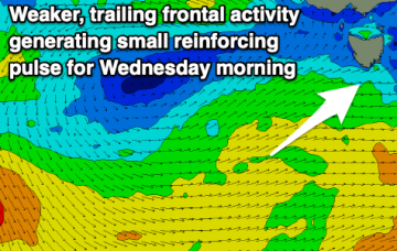
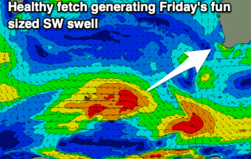
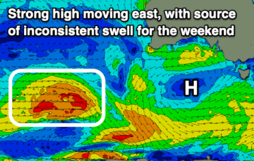
Complex outlook ahead, still some workable options
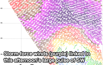
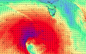
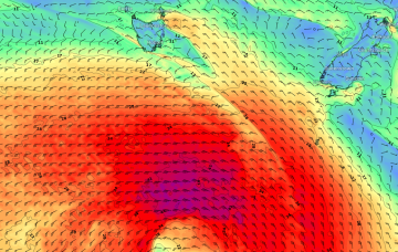
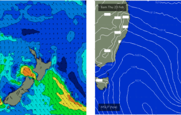
The models aren't picking it up well but I'm still expecting an interesting long period south swell to glance the coast tomorrow.
Dicey winds and weak windswells this week, a bit stronger on the weekend.
Strong swell this afternoon, easing over the coming days but only cleaning up from Wednesday.
There's not much to recommend until later week when a good new swell arrives, fun into the weekend.
Building surf but with freshening onshore winds, improving from Wednesday down South with easing, weaker surf.
A building swell with light winds is worth making the most of before things go bad from tomorrow.
OK first up, we've got some small, user-friendly east swell on the way, courtesy of a building ridge across the northern Tasman Sea, stretching out towards a small troughy feature N/NE of New Zealand on Sunday.
An interesting succession of poorly aligned but explosive Southern Ocean low pressure systems below the continent will generate a spread of acute south swell along the Southern NSW coast early next week.
A fun swell with favourable conditions is due on Sunday ahead of a bombing low and strong W/SW groundswell early next week.