Stacked forecast with lots of wind and swell ahead
Monday, 23 October 2023
Stacked forecast with lots of wind and swell ahead
Monday, 23 October 2023
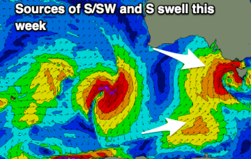
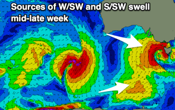
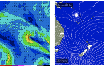
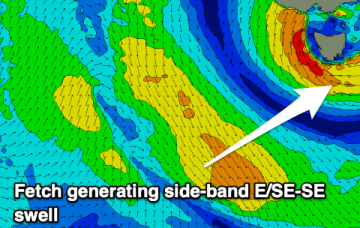
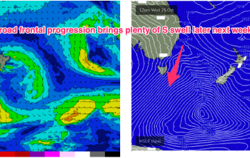
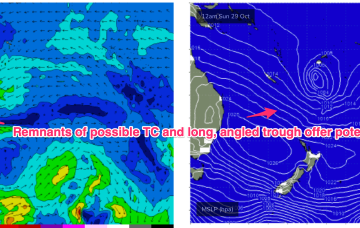
Late in the week, a combination of inland upper trough and a long angled trough extending from TC Lola remnants is expected to form a powerful surface low off the sub-tropical NSW Coast (likely between Lord Howe and Norfolk Is). As modelled, gales will produce a large E’ly quadrant swell event, with maximum size in Northern NSW, grading smaller into temperate NSW. A secondary October surprise that looks to be a major swell producer