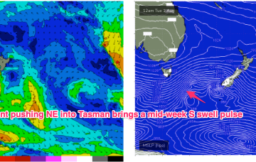
Mid week S swell and another round of extended tradewind swell to look forwards to
Monday, 31 July 2023
Mid week S swell and another round of extended tradewind swell to look forwards to
Monday, 31 July 2023
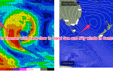
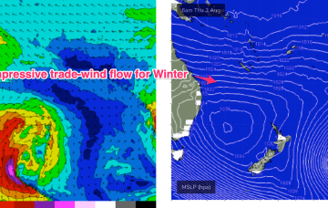
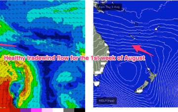
Once the dominant high enters the Tasman on Wed we’ll see a SE’ly to E'ly tradewind pattern start to establish through the Coral Sea, more typical of Summer, likely extending into the weekend with plenty of workable tradewind swell associated with it.