Fun swells continue for the Surf Coast
Friday, 28 July 2023
Fun swells continue for the Surf Coast
Friday, 28 July 2023
Fun sized swells with favourable conditions continue for the Surf Coast.
Fun sized swells with favourable conditions continue for the Surf Coast.
Easing surf ahead of a new pulse of strong swell mid-next week.
We've got clean conditions and fun pulses of swell for the coming days.
Onshore winds and large swells will persist this period with windows across Perth and Mandurah, and one window across the South West.
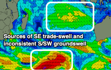
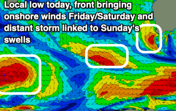
We’ve still got a massive high pressure system (1037 hPa) moving over inland NSW, slowly weakening as it enters the Tasman Sea through tomorrow and over the weekend. The high has created a firm ridge up the QLD Coast and a broad swathe of fresh SE breezes to strong winds in the Coral Sea.
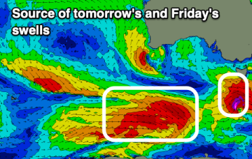
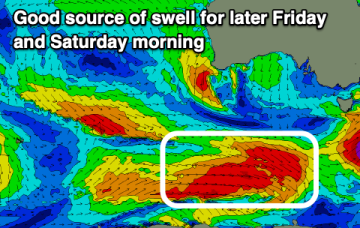
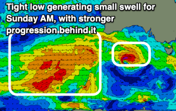
A more compact but even stronger storm is right behind it, reaching peak strength halfway across the lower Tasman before slamming into the South Island. Fresh NW-W winds are then expected over the weekend before another series of fronts traverse the lower Tasman next week.
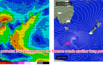
We’ve still got a massive high pressure system (1037 hPa) moving over inland NSW, slowly weakening as it enters the Tasman Sea through tomorrow and over the weekend. The ridge up along the sub-tropical coast will break down as it does so. A powerful front has passed through the Tasman, creating a pulse of long period S’ly groundswell.
A powerful front has passed through the Tasman, creating our current S’ly groundswell. A more compact but even stronger storm is right behind it, reaching peak strength halfway across the lower Tasman before slamming into the South Island.
We've got less than ideal winds for the Mid over the coming days and weekend while the South Coast will offer plenty of surf. Early next week looks interesting.
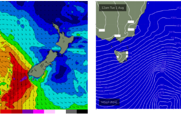
We've got easing surf with a window to the east tomorrow, ahead of a fun sized SW swell for the weekend. Larger W/SW swells are due early-mid next week.