Poor end to the week, good next

Victorian Surf Forecast by Craig Brokensha (issued Wednesday November 24th)
Best Days: This morning, Monday morning on the beaches, Tuesday, Wednesday morning, Thursday morning, Friday
Features of the Forecast (tl;dr)
- Mix of small swells tomorrow with moderate S/SW-S winds, freshening during the PM
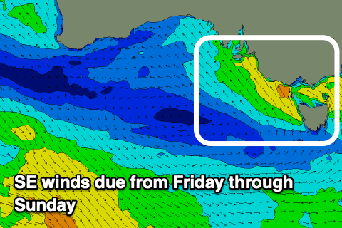
- Strong SE winds with a building SE windswell Fri, easing Sat as winds remain strong from the SE
- Inconsistent W/SW groundswell Fri
- Easing SE windswell Sun with fresh SE winds
- Inconsistent SW swell Mon with light E/NE-NE winds and SE sea breezes
- Good W/SW groundswell Tue with NE tending E/NE winds
Recap
Great surf yesterday with a new pulse of building SW groundswell and favourable winds all day for the beaches and selected reefs. The Mornington Peninsula came in around 4-5ft with sets pushing to 3ft and a little more at times on the Surf Coast.
This morning the swell has backed off a touch and conditions are still favourable with light winds and surf to 4ft on the Mornington Peninsula and 2-3ft across the Surf Coast.


Fun waves yesterday afternoon
This week and weekend (Nov 25 - 28)
 Make the most of this morning’s clean conditions and fun waves as from the afternoon we’ll see a trough moving in, bringinging an onshore change.
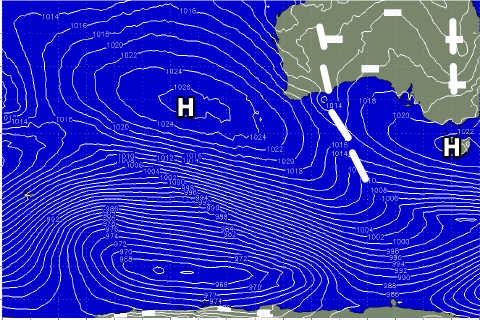
This trough will move further east tomorrow and then form into a low off the far southern NSW coast as a high pressure system ridges in from the west. This will see moderate S/SW-S breezes tomorrow, freshening through the afternoon.
Come Friday when the low develops we’ll see strong SE winds kick in through Bass Strait, persisting through Saturday owing to the stalling nature of the low.
This will produce a moderate sized SE windswell that should reach 3-4ft throughout the afternoon on the Surf Coast Friday, easing back from a similar size Saturday morning. The Mornington Peninsula looks to be a similar size with an inconsistent W/SW groundswell in the mix.
 Come Sunday winds will ease back though still be fresh from the SE with a slow easing in the SE windswell energy.
Next week onwards (Nov 29 onwards)
Moving into next week we’ve got a unique setup of persistent winds from the north-eastern quadrant as high pressure sets up from the south-east of the country over to New Zealand, with inland surface troughs squeezing from the north.
This will favour the beaches and we’ll see a couple of significant cold fronts slipping in from the west, then tracking east-southeast as they interact with the high.
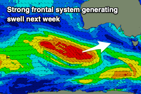 This will bring moderate pulses of W/SW groundswell, the first filling in Monday and peaking Tuesday with the second for Friday/Saturday.
Size wise the first looks to be around 4-6ft on the Mornington Peninsula and 3ft on the Surf Coast Tuesday with morning NE winds, but we’ll have a closer look at this Friday.
Comments
Much better work with the weather next week, Craig. Good stuff.
Woolamai used to be the Best Vic Cam. It’s been Rubbish for 2 Years. It’s Why I’m a Subscriber. Saves me a Lot of Petrol Money or it Used to. Ben put us out of our Misery Please.
We sent down replacement hardware a few weeks ago, just waiting for our local sparky to swap over. Should be sometime in the next week or so. Thanks for your patience.
Not that hard to tell if it is good conditions for Woolamai. It's like Portsea to Gunnamata but the banks are always shitloads better and less crowded. I'm more pissed off that you cant take the kids for a haunted walk around the run-down boy's home on boy's home rd anymore. Can you sort that out too Ben?