Easing surf, slowed by a reinforcing mid-period W/SW swell

Victoria Forecast by Craig Brokensha (issued Monday 24th December)
Best Days: Keen surfers Surf Coast tomorrow morning, beaches Thursday morning
Recap
Poor waves over the weekend with a small, weak and onshore swell Saturday, cleaner on the Surf Coast yesterday but tiny.
Today our new SW swell has filled in nicely and already hit the 3ft range on the Surf Coast and 4-6ft to the east, and with Cape Sorell just reaching a peak, 4ft sets are likely on the Surf Coast during the afternoon with the odd bigger bomb on the peninsula.

Winds look to remain favourable into this afternoon across most locations, so make the most of the conditions as tomorrow is now looking average.
Today’s Forecaster Notes are brought to you by Rip Curl
This week and weekend (Dec 25 - 30)
Unfortunately winds are now looking average across all locations tomorrow as a weak trough moves in from the west, bringing a moderate SW breeze, that will tend more S'ly through the day.
The onshore wind shouldn't be too strong and ease off a little through the morning creating workable waves for keen surfers across both regions. Today's swell is due to ease back from 3ft on the sets across magnets on the Surf Coast and 4-5ft to the east.
Wednesday morning looks a little smaller and winds will be onshore out of the SE and only moderate but creating average conditions with 2ft+ waves on the Surf Coast and surf to 4ft on the Mornington Peninsula.
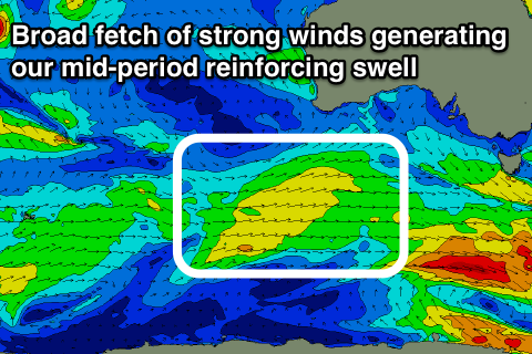 Into the afternoon and more so Thursday a fun new mid-period W/SW swell is expected, generated by a relatively weak but broad fetch of W/SW winds passing under WA and pushing towards us yesterday and today, dipping east-southeast on approach tomorrow.
The Surf Coast will mostly be around 2ft or so, but we may see the rare 3ft'er on the magnets early, easing through the day, with easing 3-4ft+ sets on the Mornington Peninsula.
Winds will improve across both coasts with a variable tending E/NE-NE breeze due to develop through the morning favouring the beaches before sea breezes kick in.
Come Friday the surf will be small and fading from 1-2ft max on the Surf Coast and 2ft to maybe 3ft to the east along with a SW tending S/SE breeze (likely W/NW early on the Surf Coast).
There's nothing significant due into the weekend as the surf bottoms out Saturday, while a small weak mix of mid-period W/SW swells are due to fill in Sunday. These will be produced by weak and small fronts projecting towards and under WA through our westerns well window, not ideal at all for the Surf Coast. Only a minimal 1-2ft of swell may be seen with 3ft sets to the east under favourable N'ly winds.
Longer term more of the same is expected, but more on this Wednesday. Merry Christmas!
Comments
Swell looks to be peaking at 3-4ft on the Surf Coast..
Cracking day of waves at the Island today and crowds still reasonably lite. That will change Boxing Day no doubt.
Where was everybody? It's not as if the swell and conditions weren't forecasted
Probably xmas shopping. ;)
It would have helped that there were waves everywhere and the winds weren't confining everyone to the reefs.
Looking good again early this morning.
Few Noah’s around the traps