Plenty of swell with tricky winds
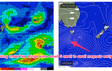
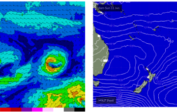
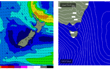
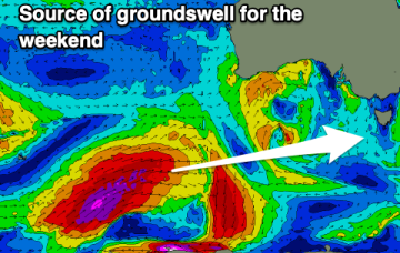
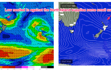
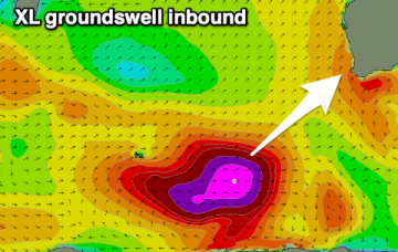
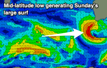
The swell will continue to push in over the coming period but local winds are poor for the South West with windows to the north.
That will supply groomed conditions for a small but fun E/SE swell signal coming off the top of the North Island ( better aimed at targets to the North)
A quiet start to next week is still on the cards- in fact the whole of next week now looks fairly subdued as a complex low becomes slow moving and drives a mostly offshore flow up the Eastern Seaboard.
A large, strong SW groundswell will fill in tomorrow, easing Sunday with excellent winds for the South Coast.
Offshore winds and some great quality swell is due over the coming days, fading through next week with stronger northerly winds.
The weakening high is seeing a slow easing and contraction to the North of the tradewind fetch in the Coral Sea which has been supplying CQ with fun wave since the weekend.
The evolution of the current pattern has sped up compared to Monday’s notes with high pressure drifting towards the South Island and weakening and a low centred around the North Island moving NE. An approaching decaying front and inland trough will bring a strengthening N’ly flow tomorrow and peak in NE windswell with the end of the week seeing smaller, offshore conditions.
The surf will become near flat into the end of the week ahead of a new swell for the weekend.
The evolution of the current pattern has sped up compared to Monday’s notes with high pressure drifting towards the South Island and weakening and a low centred around the North Island moving NE. A fetch off the top of the North Island is just scraping the edge of our swell window (better aimed at the sub-tropics).
The windows for a clean wave across the South West are very limited. You'll have more luck to the north.