Windows of fun waves -mainly to the east

Victoria Forecast by Craig Brokensha (issued Monday 9th February)
Best Days: Tuesday until mid-afternoon east of Melbourne, early Wednesday, Friday morning protected spots east of Melbourne, Saturday morning east of Melbourne, early Sunday both coasts
Recap
Tiny clean waves on the Surf Coast Saturday and with exposed breaks across the state fairing best with a touch more size under offshore breezes. An onshore change moved in just before dawn Sunday creating terrible conditions across all locations.
Today the swell is a touch bigger but with lingering onshore winds from the S'th, but these have since tended more variable as expected. We'll see a strong E/SE'ly kick up into the afternoon and evening though, producing building levels of windswell late across the Surf Coast.
 This week (Feb 10 - 13)
Tomorrow is still looking fun east of Melbourne and across selected beaches on the Surf Coast with a mix of new inconsistent SW groundswell and easing SE windswell.
The SW groundswell was generated through the weekend by a strengthening but not overly significant polar frontal progression which has since passed under Tassie.
The Surf Coast should see inconsistent 2-3ft waves with 4-5ft+ sets on the Mornington Peninsula early – easing through the day - while there'll also be an easing SE windswell from 2ft to maybe 3ft from strong overnight E/SE winds through Bass Strait.
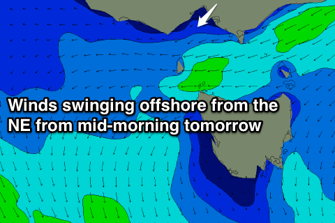
Conditions will improve through the morning as early morning E/NE breezes swing NE through the mid-morning and then tend variable before mid-late afternoon sea breezes kick in.
Therefore don't aim for the early, go for a paddle from mid-morning onwards. The Surf Coast will be poor early but winds may tend light N/NE mid-morning opening up selected beaches for a fun peaky surf.
Wednesday morning should be clean early with a variable breeze across most locations, but the swell will be small and easing from 2ft on the Surf Coast and 3-4ft+ on the Mornington Peninsula. Aim for a morning surf as a strong SW change will push through around midday.
Wednesday's afternoon kick in new long-range and very inconsistent W/SW groundswell followed by a slightly bigger and more consistent W/SW swell for Thursday (peaking into the afternoon) are still on track but winds will be poor.
Thursday's swell should see the Surf Coast kick to a good 3ft through the day with 5-6ft sets on the Mornington Peninsula but onshore winds Wednesday afternoon from the SW will swing S/SE into Thursday morning and remain fresh before strengthening from the E/SE later.
Friday will remain average with a mix of easing W/SW groundswell and E/SE windswell under strong E'ly winds. Keen surfers should head to protected locations east of Melbourne with easing 4-6ft waves.
This weekend onwards (Feb 14 onwards)
Saturday looks great for a surf east of Melbourne as Thursday's W/SW groundswell continues to ease to a more manageable size on the beaches under offshore N/NE winds. The Mornington Peninsula should see easing 3-4ft+ waves with 2ft peaks on the Surf Coast.
Come Sunday a small kick in long-range and inconsistent W/SW groundswell should keep the Surf Coast around 2ft and the Mornington Peninsula 3-4ft under early N/NW tending W/SW winds as a weak cold front pushes through the region.
Longer term we may see a better SW groundswell developing for Tuesday/Wednesday next week from a strong and slow moving polar low firing up around Friday to the south-west of WA. This is a fair way down the track though, so check back Wednesday for an update on this.