Stormy weekend ahead for South Oz
Wednesday, 5 April 2017
Stormy weekend ahead for South Oz
Wednesday, 5 April 2017
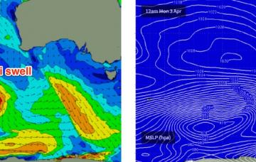
A series of fronts through the Southern Ocean will generate a small, slow increase in size over the coming days.
A series of fronts through the Southern Ocean will generate a small, slow increase in size over the coming days.
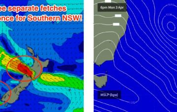
Winds will strengthen from the NNW on Saturday as a cold front approaches and this will create problems east of Melbourne. As such our weekend focus will be west of Melbourne.
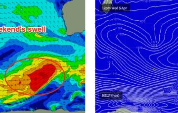
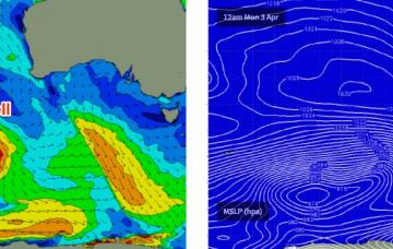
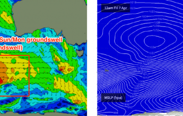
We’ve had a steady progression of frontal systems through the Southern Indian Ocean over the last few days, and although they’re not overly strong and a large distance from the mainland, are generating new swell that will build slowly over the coming days.
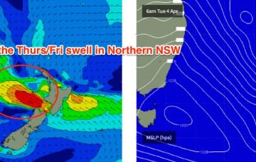
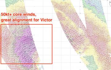
A strong ridge extends across the Central/Northern Tasman Sea, aimed up into the Coral Sea. This fetch is stationary, aimed nicely into the Coral Sea and will continue to pump out similar sized surf over the coming days.
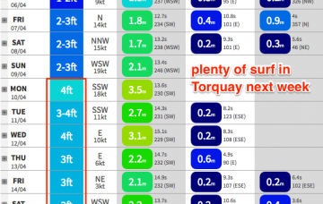
Plenty of surf this week but tricky winds for the next few days.
These swells won’t do a lot down south but with offshore winds it’ll be well worth a drive.
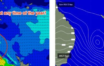
A series of modest fronts through the Southern Ocean now and over the coming days (pushing east of Heard Island at the moment) will produce some small new swells for the second half of the week though no major size is expected.
The next week looks unreal for the SE Qld points.
The second half of next week looks unreal.
Unfortunately, the peak of this swell will coincide with a cold front crossing the region - attached to the same low that produced the swell (though it's now weakening).