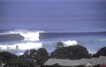
Couple of fun days ahead
Friday, 25 October 2019
Couple of fun days ahead
Friday, 25 October 2019
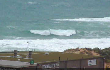
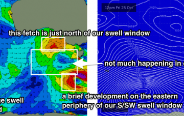
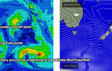
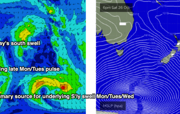
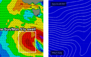
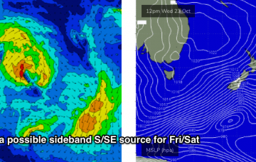
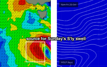
So, we’ve got a lot of swell and wind lining up on the weekend charts and graphs. But, the surf outlook it’s not quite as straightforward as you might otherwise think. More in the Forecaster Notes.