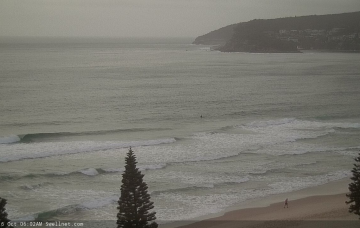
Inbound: lots of swell, lots of wind
Wednesday, 16 October 2019
Inbound: lots of swell, lots of wind
Wednesday, 16 October 2019
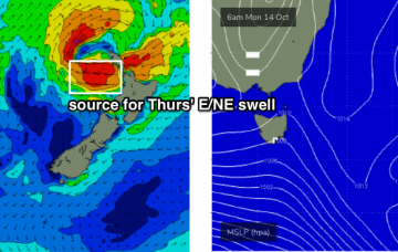
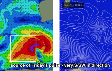
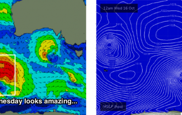
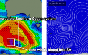
There’s been a small downgrade for the weekend’s swell. But, it’s still looking to be very large and quite windy. More in the Forecaster Notes.