Our slow run of swell kicks in thanks to SAM
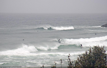
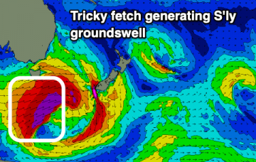
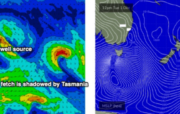
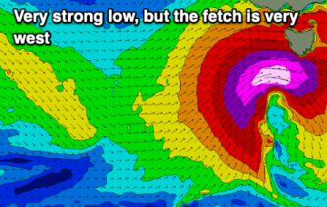
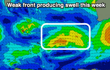
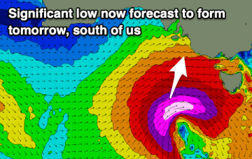
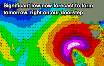
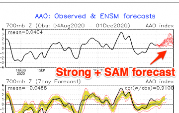
The coming forecast period is slow and not the cleanest owing to a positive Southern Annular Mode event. More info in the notes.
Today's large, building S/SW groundswell will peak later and then ease over the coming days as winds improve. Another strong low is due on the weekend, but further north in position.
Today's large, building groundswell will ease steadily over the coming days as winds provide options across most locations at stages. Another less favourable low is due to form on the weekend.
There’s a couple of swell sources on the synoptics right now. More in the Forecaster Notes.
We've got swells from either side of the compass this period, firstly north, then south, then north, then south again.
The main synoptic feature is a deep Southern Ocean low that's expected to *almost* bomb just W/SW of Tasmania. By ‘almost’, I mean ‘not quite reach the threshold requirements for a bombing low’, which is a 24hPa drop in 24 hours, though it certainly will come pretty close. More in the Forecaster Notes.
A significant low is forecast to form in our swell window tomorrow, with plenty more swell to follow.
The surf outlook following today's strong cold front is the quietest it's looked in a while.
A significant, strong low is set to form south of us tomorrow, bringing another large swell.
A deep, powerful low will develop in our swell window this period, generating a large, significant swell.